Mount Dandenong (Victoria)
| Mount Dandenong | |
|---|---|
| Corhanwarrabul | |
 Mount Dandenong, as viewed from Mooroolbark | |
| Highest point | |
| Elevation | 633 m (2,077 ft)[citation needed] |
| Prominence | 364 m (1,194 ft)[1] |
| Isolation | 23.1 km (14.4 mi)[1] |
| Listing | List of mountains in Australia |
| Coordinates | 37°49′38″S 145°21′10″E / 37.82722°S 145.35278°E[2] |
| Geography | |
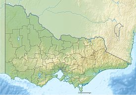
Location in Victoria | |
| Country | Australia |
| State | Victoria |
| Protected area | Dandenong Ranges National Park |
| Parent range | Dandenong Ranges, Great Dividing Range |
Mount Dandenong (Aboriginal Woiwurrung language: Corhanwarrabul[3]) is a mountain that is part of the Dandenong Ranges of the Great Dividing Range, located in the Central District of Victoria, Australia. The mountain has an elevation of 633 metres (2,077 ft) [4] and is located approximately 45 kilometres (28 mi) east of Melbourne.
Geology
[edit]The mountain is the remains of a massive and explosive volcanic eruption over 300 million years ago. This has left the ranges spread between Coldstream, Emerald and south of Ferntree Gully.[5][6]
Features
[edit]Mount Dandenong features parks, forests, an arboretum, numerous lookouts and many restaurants.
Lookouts
[edit]

Close to the summit of the mountain sits the SkyHigh Mount Dandenong restaurant, gardens and maze, re-opened in 2005.
On a clear day it is possible to see across the metropolitan area to the You Yangs and Mount Macedon, putting the Melbourne Central Business District and Port Phillip Bay into a broader geographical context.
The summit
[edit]

The peak of the mountain, at 633 m above sea level, is also the site of the television and FM radio signal towers for the greater Melbourne area, which range in height from 72 m to 180 m. These towers are visible from quite a distance and distinguish Mount Dandenong from others in the Dandenong Ranges.
Tourist road
[edit]Mount Dandenong Tourist Road, the main road going through Mount Dandenong, is host to many local shops. These include cafes, restaurants and eateries, pubs, day spas, wine and fine food purveyors, a nursery and many shops selling local crafts.[7]
William Ricketts Sanctuary
[edit]
The William Ricketts Sanctuary is situated on the east face of Mount Dandenong. It has over 93 ceramic sculptures woven into the eucalyptus forest.
SkyHigh Mount Dandenong
[edit]SkyHigh Mount Dandenong is a restaurant on top of the mountain.
In the 1970s and '80s, the site was an iconic Melbourne attraction, and was well-known to most Melburnians; however, in the early 1990s the site fell into disrepair, and the building began to look aged and dilapidated. This culminated with the site being shut down completely in 1997.[citation needed]
In 2004, a new lease was negotiated with Parks Victoria, the government authority in charge of the land. The restaurant and surrounding gardens were given a $3.5 million facelift, and the site re-opened in December 2004, with the name officially being changed from "Mount Dandenong Observatory" to the current "SkyHigh Mount Dandenong".[citation needed]
The renovations to the site included construction of an upstairs balcony and an enlarged viewing window. Besides work on the building itself, the surrounding land was graded and landscaped, and many new plants added and the hedge maze started.[citation needed]
Prior to 2021 SkyHigh had employed up to 90 people. Efforts to reopen following Victoria's Covid lockdown were thwarted when SkyHigh was extensively damaged by storms in 2021.[8]
The English Garden has grown significantly since being planted in 2005. It features meandering gravel paths and several wooden arch bridges crossing a man-made stream, constructed as part of the renovations.
The SkyHigh Maze, designed by John Connellan, opened in 2007.[citation needed] The maze features garden squares designed around fountains, and a trompe-l'œil.
The Giant’s Chair is a large novelty wooden chair on the front lawn of the site.
The Kugel ball is a sculpture consisting of a large granite ball supported by a very thin film of water.
The Australiana Tree is a large gum tree. Rapidly dying after being struck by lightning in 2006, it has been carved into the shape of many native animals in a totem pole style.
See also
[edit]References
[edit]- ^ a b "Mount Dandenong, Victoria". Peakbagger.com. Retrieved 25 May 2023.
- ^ "Mount Dandenong". Gazetteer of Australia online. Geoscience Australia, Australian Government.
- ^ Info sourced from Knox Historical Society - on place names in the area Archived 17 March 2012 at the Wayback Machine
- ^ "Mount Dandenong". Travel Victoria. Retrieved 22 August 2024.
- ^ "Dandenong Ranges".
- ^ "Geocaching - the Official Global GPS Cache Hunt Site".
- ^ "Mount Dandenong Attractions". www.about-australia.com. Archived from the original on 25 July 2008.
- ^ Preiss, Benjamin (23 June 2021). "'Massive financial hit': Dandenong Ranges businesses smashed by storms". The Age. Retrieved 17 July 2023.

