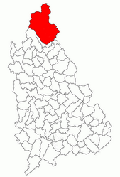
Moroeni
Appearance
You can help expand this article with text translated from the corresponding article in Romanian. Click [show] for important translation instructions.
|
Moroeni | |
|---|---|
 | |
 Location in Dâmbovița County | |
| Coordinates: 45°14′29″N 25°27′2″E / 45.24139°N 25.45056°E | |
| Country | Romania |
| County | Dâmbovița |
| Government | |
| • Mayor (2020–2024) | Mihai-Laurențiu Moraru[1] (PSD) |
Area | 287.39 km2 (110.96 sq mi) |
| Elevation | 545 m (1,788 ft) |
| Highest elevation | 2,505 m (8,219 ft) |
| Population (2021-12-01)[2] | 5,034 |
| • Density | 18/km2 (45/sq mi) |
| Time zone | EET/EEST (UTC+2/+3) |
| Postal code | 137310 |
| Vehicle reg. | DB |
Moroeni, also spelled Moroieni, is a commune in Dâmbovița County, Muntenia, Romania. It is composed of six villages: Dobrești, Glod, Lunca, Moroeni, Mușcel, and Pucheni.
The commune is located at the northern extremity of the county, covering the southern end of the Bucegi Mountains. The Ialomița River, which has its source just north of Moroeni, flows through it.
References
[edit]- ^ "Results of the 2020 local elections". Central Electoral Bureau. Retrieved 8 June 2021.
- ^ "Populaţia rezidentă după grupa de vârstă, pe județe și municipii, orașe, comune, la 1 decembrie 2021" (XLS). National Institute of Statistics.


