Moriah Harbour Cay National Park
Appearance
| Moriah Harbour Cay National Park | |
|---|---|
 | |
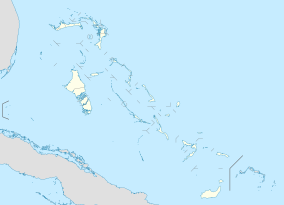
| Location | Exuma, the Bahamas |
| Coordinates | 23°27′41″N 75°40′32″W / 23.46133°N 75.67548°W[1] |
| Area | 16,800 acres (68 km2) |
| Established | 2002 |
| Governing body | Bahamas National Trust |
| bnt | |
Moriah Harbour Cay National Park is a national park in Exuma, the Bahamas. The reserve was established in 2002 and, after expansion in 2015,[2] has an area of 16,800 acres (68 km2).[3]
Flora and fauna
[edit]On land, the park provides nesting sites for gull-billed and least terns, nighthawks, oystercatchers, plovers, and a resident pair of ospreys. Plants found at the park include buttonwoods, bay cedar, palmettos and sea oats. The park's mangroves provide a nursery for crabs, crawfish, conch, mangrove snappers, yellowtails and groupers.[3]
References
[edit]- ^ "Moriah Harbour Cay National Park in Bahamas". Protected Planet. Archived from the original on 2019-01-04. Retrieved 4 January 2019.
- ^ "New Marine Protected Areas Declared in The Bahamas!". The Atlantis Blue Project Foundation. September 2015. Archived from the original on 2019-04-12. Retrieved 4 January 2019.
- ^ a b "Moriah Harbour Cay National Park". The Bahamas National Trust. Archived from the original on 2019-04-27. Retrieved 4 January 2019.

