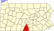
Monterey, Pennsylvania
Monterey, Pennsylvania | |
|---|---|
populated place | |
| Coordinates: 39°44′17″N 77°28′17″W / 39.73806°N 77.47139°W[1] | |
| Country | United States |
| State | Pennsylvania |
| County | Franklin |
| Township | Washington |
| Established by | 1875 |
| Area | |
| • Total | 250 sq mi (600 km2) |
| Elevation | 1,335 ft (407 m) |
| ZIP code | 17214 |
| Area code | 717 |
| Census code | 50600[1] |
| GNIS ID | 1181451[1] |
| NRHP # | 76001639 [1] |
Monterey, Pennsylvania, is an unincorporated community which was added to the USGS Geographic Names Information System on August 2, 1979.[1] After the site was surveyed c. 1839 for the never-completed Tapeworm Railroad, the summit community was settled on the Emmitsburg & Waynesboro Turnpike [2] east of the Nichol's Gap Road intersection near the Toll Gate and Brown's Spring[3] and later bypassed by the 20th century Pennsylvania Route 16 highway.
As with the Pen Mar Park to the south, Monterey was the site of numerous resort facilities such as the Clermont House,[4] 1887 Monterey Hotel,[3] the Monterey House,[4] the Monterey Inn, the Monterey Academy,[5] and the Monterey Country Club. The community's post office established in the late 19th century was named Charmian (another PA post office already was named Monterey),[4]: 7 and the Charmian station of the Baltimore and Harrisburg Railway was established after the Western Extension was laid in 1888–1889 (cf. Monterey Station in 1872).[5]
Civil War
[edit]As a mountain community near the intersection of the turnpike and the Nichol's Gap Road, the Monterey area was an 1863 American Civil War site through which both Federal and Confederate forces maneuvered during the Gettysburg Campaign[6] (e.g., Buford's Cavalry en route to a June 29/30 Fountaindale bivouac)[6] and a military engagement during the retreat from Gettysburg was at the Monterey location. On July 5, prisoners of war encamped at [7] and east of the site,[8] and "two soldiers of the Fourth Carolina Cavalry" were buried "near the gatehouse of the Monterey Springs".[9]
References
[edit]- ^ a b c d "Monterey (1181451)". Geographic Names Information System. United States Geological Survey, United States Department of the Interior. Retrieved November 15, 2011.
- ^ "X_Value=-77.4713784&Y_Value=39.7381501". USGS Elevation Web Service Query]. United States Geological Survey. Retrieved June 24, 2011.
- ^ Department of the Interior Geologic Survey [page 16] (PDF) (Map). US Government printing office.
- ^ a b Heritage Tour – 2008 (handout sheets), Lindy Bumbaugh (tour guide)
{{citation}}: CS1 maint: others (link) - ^ "The Fifth Regiment: Last Day of the Encampment". Baltimore American and Commercial. July 10, 1872. Retrieved November 16, 2011 – via Google News Archive.
you reach Midersburg, a small station right among the mountains, then the road describes a complete half circle in order to pass around one of the peaks and reach the summit at Monterey Station. Here a fine view of Middletown Valley is obtained… At the summit is Monterey Station, half a mile from which is Monterey Springs
Hotel. - ^ Army of the Potomac [tablet 6 of 9], on East Cemetery Hill of Gettysburg Battlefield: National Park Service
East Cemetery Hill Tablet 6 of 9
Army of the Potomac
July 4, 1863First and Second Brigade, First Cavalry Division marched from
Westminster The Reserve Brigade First Cavalry Division from
Gettysburg en route to Frederick Second Brigade Second Cavalry
Division from Westminster via Emmitsburg to Monterey The Third
Brigade Second Cavalry Division from Gettysburg to Hunterstown and the
Third Cavalry Division from Gettysburg via Emmitsburg to Monterey
Fight at Monterey Gap Pennsylvania
Skirmishes at Fairfield Gap Pennsylvania and near Emmitsburg Md


