Mont Nabemba
Appearance
| Mont Nabemba | |
|---|---|
| Highest point | |
| Elevation | 1,020 m (3,350 ft)[1] |
| Listing | Country high point |
| Coordinates | 01°51′00″N 13°59′00″E / 1.85000°N 13.98333°E[1] |
| Geography | |
| Location | Republic of the Congo |
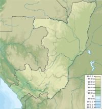
Mont Nabemba is the highest mountain in the Republic of the Congo. Located in Sangha Department around fifty kilometres from the town of Souanké,[2] the mountain has an elevation of 1,020 metres (3,346 ft).
Nabemba Tower in Brazzaville is named after the mountain.[3]
Mining
[edit]Iron ore deposits are located in the vicinity. Sundance Resources are drilling in preparation to mine the total mountain.
References
[edit]- ^ a b "Mont Nabeba" on Peakbagger.com Retrieved 2 October 2011
- ^ John F. Clark and Samuel Decalo, Historical Dictionary of Republic of the Congo, fourth edition (2012), Scarecrow Press, pages 305 and 392.
- ^ Africa Economic Digest, volume 11, issues 1–12 (1990), page 9.

