Mission Sioux Airport
Mission Sioux Airport | |||||||||||
|---|---|---|---|---|---|---|---|---|---|---|---|
| Summary | |||||||||||
| Airport type | Public | ||||||||||
| Owner | Rosebud Sioux Tribe | ||||||||||
| Serves | Mission, South Dakota | ||||||||||
| Elevation AMSL | 2,605 ft / 794 m | ||||||||||
| Coordinates | 43°18′25″N 100°37′41″W / 43.30694°N 100.62806°W | ||||||||||
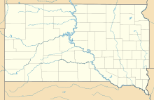
| Map | |||||||||||
 | |||||||||||
| Runways | |||||||||||
| |||||||||||
| Statistics (2009) | |||||||||||
| |||||||||||
Mission Sioux Airport (FAA LID: 0V6) was a public use airport located two nautical miles (3.7 km) east of the central business district of Mission, a city in Todd County, South Dakota, United States.[1] The airport is owned by the Rosebud Sioux Tribe.[1]
On current aviation charts, the airport is depicted as closed, with the Rosebud Sioux Tribal Airport having replaced it in late 2010. The airport is no longer listed in the Airport/Facility Directory and the runway pavement is badly deteriorated.
Facilities and aircraft
[edit]Mission Sioux Airport covers an area of 240 acres (97 ha) at an elevation of 2,605 feet (794 m) above mean sea level. It has one runway designated 11/29 with an asphalt surface measuring 3,200 by 60 feet (975 x 18 m).[1]
For the 12-month period ending June 23, 2009, the airport had 700 general aviation aircraft operations, an average of 58 per month.[1]
References
[edit]- ^ a b c d e "0V6 - Mission Sioux Airport - FAA information effective September 23, 2010". FAA data republished by AirNav. Archived from the original on October 27, 2010.
- ^ "Mission Sioux Airport (0V6)" (PDF). South Dakota Department of Transportation. Archived from the original (PDF) on January 4, 2010.

