Minsar
Minsar
Moincêr | |
|---|---|
village | |
 | |
| Coordinates: 31°11′N 80°46′E / 31.18°N 80.76°E | |
| Country | |
| Region | Tibet Autonomous Region |
| Prefecture | Ngari |
| County | Gar |
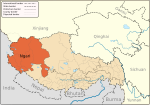
Minsar[1] or Moincêr[a] (Tibetan: མོན་འཚེར, Wylie: mon 'tsher, THL: mön tser)[2] is a village and the centre of a township in the Ngari Prefecture of the Tibet region of China.[3] It is legally an enclave of India in Tibet, occupied by China since 1959.[4][5]
Minsar is located south-west of Mount Kailash (Mount Ti-se). It is close to the Tirthapuri Monastery on the bank of the Sutlej River. The Chinese National Highway G219 passes by Minsar.
History
[edit]Prior to the Tibet–Ladakh–Mughal War (1679–1684), the Kingdom of Ladakh controlled the whole of the Ngari region (present day western Tibet). Central Tibet, consolidated by the Fifth Dalai Lama, conquered and occupied Ngari, but was driven back from Ladakh proper by the forces of the Mughal Empire from Kashmir.[b] Lhasa sent the sixth Drukchen from Bhutan, Gyalwang Mipham Wangpo to negotiate truce terms with Ladakh. In the resulting Treaty of Tingmosgang, Ladakh agreed to cede the whole of western Tibet to Lhasa retaining only a tract around Minsar for supporting the worship at Mount Kailas.[6]
Minsar appears to have been used for porterage for the Ladakhi trade caravans to Tibet.[7]
Economy
[edit]Minsar depends on its small coal-mining industry; from which it once produced large amounts of ore from its nearby mines. The village is small and its villagers live depending heavily on yaks for agriculture and trade.[citation needed]
Gallery
[edit]-
Map including Minsar ("Menze or Missar") and Tirthapuri Gompa
-
A side street of Moincêr
-
Statue of Milarepa in Tirthapuri Gompa
Notes
[edit]References
[edit]- ^ a b Mehra, Parshotam (1992), An "agreed" frontier: Ladakh and India's northernmost borders, 1846-1947, Oxford University Press, p. 236, ISBN 978-0-19-562758-9: "Minsar (Missar) – Ladakhi enclave in West Tibet close to Lake Manasarowar; during the Dogra-Tibet War (1841-2), the Dogras stored their supplies here."
- ^ a b "Geographical names of Tibet AR (China): Ngari prefecture". KNAB Place Name Database. Institute of the Estonian Language. 2018-06-03.
- ^ Moincêr Township, OpenStreetMap, retrieved 16 August 2022.
- ^ Fisher, Rose & Huttenback, Himalayan Battleground (1963), pp. 125–126.
- ^ Claude Arpi, China celebrates its Republic day in Minsar, the Indian village in Tibet, Indian Defence Review, 6 October 2019.
- ^ Bray, Ladakhi and Bhutanese Enclaves in Tibet (2003), pp. 192–193.
- ^ Fisher, Rose & Huttenback, Himalayan Battleground (1963), pp. 125–126
Bibliography
[edit]- Bray, John (2003), "Ladakh! and Bhutanese Enclaves in Tibet", in Alex McKay (ed.), History of Tibet, Volume 3: The Encounter with Modernity: c.1895-1959, Routledge, pp. 191–201, ISBN 0-415-30844-5 – via archive.org
- Fisher, Margaret W.; Rose, Leo E.; Huttenback, Robert A. (1963), Himalayan Battleground: Sino-Indian Rivalry in Ladakh, Praeger, pp. 125–126 – via archive.org


