Mikstat
Appearance
Mikstat | |
|---|---|
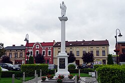
 Market Square in Mikstat | |
| Coordinates: 51°32′N 17°58′E / 51.533°N 17.967°E | |
| Country | |
| Voivodeship | Greater Poland |
| County | Ostrzeszów |
| Gmina | Mikstat |
| Area | |
• Total | 2.49 km2 (0.96 sq mi) |
| Elevation | 215 m (705 ft) |
| Population (2011) | |
• Total | 1,906[1] |
| Time zone | UTC+1 (CET) |
| • Summer (DST) | UTC+2 (CEST) |
| Postal code | 63-510 |
| Vehicle registration | POT |
| Voivodeship roads | |
| Website | http://www.mikstat.pl |
Mikstat [ˈmʲikstat] (German: Mixstadt) is a town in Ostrzeszów County, Greater Poland Voivodeship, Poland, with 1,906 inhabitants (2011).
Mikstat was royal town of the Kingdom of Poland, administratively located in the Ostrzeszów County in the Sieradz Voivodeship in the Greater Poland Province.[2]
References
[edit]- ^ "Mikstat (Urban-Rural Commune, Kalisz Subregion, Poland) - Population Statistics, Charts, Map and Location".
- ^ Atlas historyczny Polski. Województwo sieradzkie i województwo łęczyckie w drugiej połowie XVI wieku. Część I. Mapy, plany (in Polish). Warszawa: Instytut Historii Polskiej Akademii Nauk. 1998. p. 4.


