Melnsils
Appearance
Melnsils
Livonian: Mustānum | |
|---|---|
Village | |
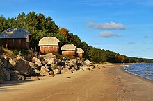
 Melnsils water tower. | |
| Coordinates: 57°39′09.4″N 22°34′25.0″E / 57.652611°N 22.573611°E | |
| Country | |
| Municipality | Talsi Municipality |
| Parish | Roja Parish |
| Elevation | 43 ft (13 m) |
| Population (2015) | |
• Total | 164 |
| Time zone | UTC+2 (EET) |
| • Summer (DST) | UTC+3 (EEST) |
| Postal code | LV-3276 Melnsils |
Melnsils (Livonian: Mustānum) is a small village in Roja Parish, Talsi Municipality in the Courland region of Latvia. It is one of twelve Livonian villages on the Līvõd rānda - the Livonian Coast.
Melnsils camping
[edit]

Melnsils camping site is located right by the sea, just 10 km away from Kolka, near the Slītere National Park, the sea-cliffs, and fascinating walking paths in the woods. It is located about 1 km from the highway P131.
Melnsils camping site is ideal for recreational activities and organization of sports events for up to 300 persons.
Climate
[edit]The continental climate prevails in the area. The annual average temperature is 6 °C. The warmest month is August, when the average temperature is 17 °C, and the coldest is January, with -4 °C.[1]

