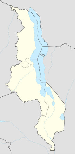
Mbalachanda
Appearance
Mbalachanda | |
|---|---|
| Coordinates: 11°27′00″S 33°59′51″E / 11.45000°S 33.99750°E | |
| Country | Malawi |
| Region | Northern Region, Malawi |
| Municipality | Mzimba District |
| Established | 1920 |
| Area | |
• Total | 70.14 km2 (27.08 sq mi) |
| Population (2018) | |
• Total | 19,120 |
| • Density | 270/km2 (710/sq mi) |
| Racial makeup (2018) | |
| • Black African | 98.5% |
| • Asian | 0.3% |
| • White Malawians | 0.2% |
| • Mixed | 0.1% |
| • Other | 0.9% |
| First languages (2018) | |
| • Tumbuka | 96.1% |
| • Chewa | 1.2% |
| • Tonga | 1.3% |
| • Ngonde | 0.4% |
| • Other | 1.0% |
| Time zone | UTC+2 |
Mbalachanda is a residential town in Mzimba District, Malawi.[1] The town is located in Mbalachanda Ward and is home to Mbalachanda Health Care.[2] It is located East of Mzimba in the Northern Region. Chitumbuka is the predominant language spoken in the area which is also the official regional language of the Northern Region of Malawi. Nearby towns include Mzalangwe, among others.[3][4]
Institutions
[edit]- Mbalachanda Health Centre
- Mbalachanda Orphan Care
- Mbalachanda Health Centre
- Mbalachanda Primary School
- Mbalachanda Community Day Secondary School
References
[edit]- ^ "Fear engulfs Mzimba over 38 tombstones desecrated in Malawi graveyards - Malawi Nyasa Times - News from Malawi about Malawi". www.nyasatimes.com. 2013-02-11. Retrieved 2024-05-12.
- ^ "Malawi electoral body assures of credible by-elections - Malawi Nyasa Times - News from Malawi about Malawi". www.nyasatimes.com. 2014-10-06. Retrieved 2024-05-12.
- ^ Reporter, Malawi24 (2022-07-07). "Teenager murdered in Mzimba Malawi 24 | Latest News from Malawi". Malawi 24. Retrieved 2024-05-12.
{{cite web}}: CS1 maint: numeric names: authors list (link) - ^ "Farmers hail Peacock Seeds at Mzimba agriculture trade fair - Malawi Nyasa Times - News from Malawi about Malawi". www.nyasatimes.com. 2016-08-19. Retrieved 2024-05-12.


