Mawalgama
Appearance
Mawalgama | |
|---|---|
| Coordinates: 6°54′55″N 80°07′49″E / 6.91528°N 80.13028°E | |
| Country | Sri Lanka |
| Province | Western Province |
| District | Colombo District |
| Area | |
| • Land | 2.5 km2 (1.0 sq mi) |
| Elevation | 36 m (118 ft) |
| Population (2012) | |
• Total | 2,033 |
| Time zone | UTC+5:30 (Sri Lanka Standard Time Zone) |
| • Summer (DST) | UTC+6 (Summer time) |
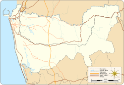
Mawalgama is a village in the Colombo District, Western Province, Sri Lanka. It is approximately 37 kn (69 km/h; 43 mph) east of Colombo and located on the Boralugoda-Mawalgama Road. The nearest railway station is the Kadugoda station.
In 2012 the population was 2,033,[1] and is located 36 m (118 ft) above sea level.
References
[edit]- ^ "Census of Population and Housing 2012" (PDF). Population by GN division and sex 2012. Department of Census and Statistics. 2012. Retrieved 5 May 2021.

