Matapalo Island
Appearance
Isla Matapalo (Spanish) | |
|---|---|
| Geography | |
| Location | Pacific Ocean |
| Coordinates | 3°26′7.34″S 80°15′27.45″W / 3.4353722°S 80.2576250°W |
| Area | 6.08 km2 (2.35 sq mi) |
| Administration | |
| Region | Tumbes |
| Additional information | |
| Time zone | |
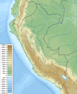
Matapalo Island is an island located in the region of Tumbes, Peru in the Pacific Ocean. It is separated from the mainland by a strait 198 – 273 m wide, in east-west orientation. With a total area of 6.08 km2, it is the biggest of the Peruvian islands in the Gulf of Guayaquil.[1]
Vegetation present in the island consists of mangrove forests, dry tropical forests and grasslands.[2]
References
[edit]- ^ Instituto Nacional de Estadística e Informática. : Departamento de Tumbes - Principales islas con indicación de su superficie, ubicación geográfica y ubicación política
- ^ Instituto Nacional de Recursos Naturales - Inrena (2007). Santuario Nacional Los Manglares de Tumbes 2007 - 2011 (in Spanish). Lima. p. 197.
{{cite book}}: CS1 maint: location missing publisher (link)

