Mao'ershan National Forest Park
Appearance
| Mao'ershan National Forest Park | |||||||
|---|---|---|---|---|---|---|---|
| 帽儿山国家森林公园 | |||||||
 Mao'ershan National Forest Park. | |||||||
| Type | Public park, state park | ||||||
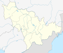
| Location | Yanji, Jilin | ||||||
| Coordinates | 42°51′40″N 129°28′32″E / 42.861223°N 129.475583°E | ||||||
| Area | 11-square-kilometre (4.2 sq mi) | ||||||
| Created | 1992 | ||||||
| Operated by | Jilin Provincial Government | ||||||
| Open | All year | ||||||
| Chinese name | |||||||
| Simplified Chinese | 帽儿山国家森林公园 | ||||||
| Traditional Chinese | 帽兒山國家森林公園 | ||||||
| |||||||
| Chinese Korean name | |||||||
| Chosŏn'gŭl | 모아산국가삼림공원 | ||||||
| |||||||
The Mao'ershan National Forest Park (Chinese: 帽儿山国家森林公园; Korean: 모아산국가삼림공원) is a national forest park located in Yanji, Jilin, China. It covers an area of 11-square-kilometre (4.2 sq mi). Located in the southern suburbs of Yanji, it is bordered by the Buerhatong River and Hailan River. Its main peak is 517.3-metre (1,697 ft) above sea level.[1][2]
History
[edit]In November 1992 it was classified as a "National Forest Park" by the State Forestry Administration.
See also
[edit]References
[edit]- ^ VR镜头下的延吉帽儿山太美啦!负氧离子溢屏而出. ifeng (in Chinese). 2018-10-26.
- ^ 【景色】感受延吉帽儿山的超高颜值!43秒有惊喜. Sohu (in Chinese). 2018-08-07.

