Manna (city)
Appearance
Manna | |
|---|---|
| Coordinates: 4°28′0.57″S 102°54′46.61″E / 4.4668250°S 102.9129472°E | |
| Country | |
| Province | Bengkulu |
| Regency | South Bengkulu Regency |
| District | Kota Manna District |
| Elevation | 115 ft (35 m) |
| Population (mid 2023 estimate[1]) | |
• Total | 32,900 |
| Time zone | UTC+7 (Indonesia Western Standard Time) |
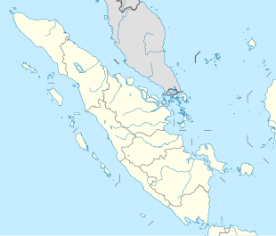
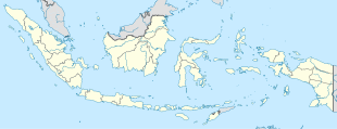
Manna is a town and the capital of South Bengkulu Regency in Bengkulu Province on the west coast of Sumatra, in Indonesia. Its population was 32,900 as at mid 2023.[1]
Climate
[edit]Manna has a tropical rainforest climate (Af) with heavy to very heavy rainfall year-round
| Climate data for Manna | |||||||||||||
|---|---|---|---|---|---|---|---|---|---|---|---|---|---|
| Month | Jan | Feb | Mar | Apr | May | Jun | Jul | Aug | Sep | Oct | Nov | Dec | Year |
| Mean daily maximum °C (°F) | 31.1 (88.0) |
31.5 (88.7) |
31.6 (88.9) |
31.8 (89.2) |
31.9 (89.4) |
31.7 (89.1) |
31.5 (88.7) |
31.4 (88.5) |
31.3 (88.3) |
31.2 (88.2) |
31.1 (88.0) |
30.8 (87.4) |
31.4 (88.5) |
| Daily mean °C (°F) | 26.6 (79.9) |
26.8 (80.2) |
26.9 (80.4) |
27.1 (80.8) |
27.1 (80.8) |
26.8 (80.2) |
26.4 (79.5) |
26.4 (79.5) |
26.6 (79.9) |
26.6 (79.9) |
26.6 (79.9) |
26.4 (79.5) |
26.7 (80.0) |
| Mean daily minimum °C (°F) | 22.1 (71.8) |
22.1 (71.8) |
22.2 (72.0) |
22.5 (72.5) |
22.4 (72.3) |
21.9 (71.4) |
21.4 (70.5) |
21.5 (70.7) |
21.9 (71.4) |
22.1 (71.8) |
22.2 (72.0) |
22.1 (71.8) |
22.0 (71.7) |
| Average precipitation mm (inches) | 240 (9.4) |
243 (9.6) |
256 (10.1) |
222 (8.7) |
199 (7.8) |
159 (6.3) |
179 (7.0) |
286 (11.3) |
386 (15.2) |
443 (17.4) |
419 (16.5) |
347 (13.7) |
3,379 (133) |
| Source: Climate-Data.org[2] | |||||||||||||
References
[edit]- ^ a b Badan Pusat Statistik, Jakarta, 28 February 2024, Kabupaten Bengkulu Selatan Dalam Angka 2024 (Katalog-BPS 1102001.1701)
- ^ "Climate: Manna". Climate-Data.org. Retrieved November 11, 2020.


