Manglares de Tumbes National Sanctuary
| Manglares de Tumbes National Sanctuary | |
|---|---|
| Santuario Nacional Manglares de Tumbes | |
 Waterway at Manglares de Tumbes National Sanctuary. | |
| Location | Tumbes |
| Nearest city | Zarumilla |
| Coordinates | 3°25′12″S 80°16′30″W / 3.42000°S 80.27500°W |
| Area | 29.72 km2 (11.47 sq mi) |
| Established | 1988 |
| Governing body | SERNANP |
| Website | Santuario Nacional Manglares de Tumbes (in Spanish) |
| Official name | Santuario Nacional Los Manglares de Tumbes |
| Designated | 20 January 1997 |
| Reference no. | 883[1] |
Manglares de Tumbes National Sanctuary is a protected natural area located in the region of Tumbes, Peru.[2] Established in 1988, it protects the largest area of mangrove forest in Peru.[3]
Geography
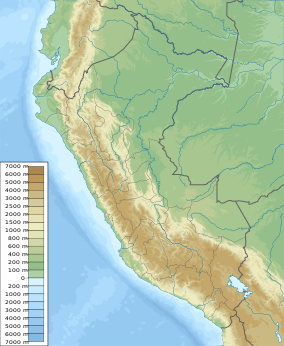
[edit]This protected area is located in Zarumilla Province, Tumbes; close to the border with Ecuador.[2][3] With an area of 29.72 square kilometres (11.47 sq mi), it harbors the largest mangrove forest in Peru.[2][3]
Ecology
[edit]Flora
[edit]Five species of mangrove dominate the area: black mangrove (Avicennia germinans), white mangrove (Laguncularia racemosa), button mangrove (Conocarpus erectus) and two species of red mangrove (Rhizophora mangle and Rhizophora harrisonii).[2][3] Seasonally dry forest and scrubland can also be found in some parts of the sanctuary; tree species representative of this ecosystem being: Pithecellobium excelsum, Cordia lutea, Mimosa acantholoba, Parkinsonia praecox, Ceiba trischistandra, Loxopterygium huasango, Bursera graveolens, Cochlospermum spp., Prosopis pallida, Capparis scabrida; and some seasonal herbaceous species: Aristida adscensionis, Bouteloua aristidoides, Stylosanthes spp., Crotalaria spp.,Tephrosia cinerea, Cyperus spp., Scirpus spp., Distichlis spicata, Antephora hermaphrodita, Paspalum racemosum, Ipomoea spp., and Bidens pilosa.[2][3]
Fauna
[edit]The sanctuary protects 148 species of birds, being some of them the yellow-crowned night heron, the rufous-necked wood rail, the American yellow warbler and the American white ibis.[2]
The sanctuary also protects 105 fish species, plus some other 40 migrant species.[2]
Mammals found in the area include the crab-eating raccoon, the silky anteater and the neotropical otter.[2][3]
Also, 33 snail species, 34 crustacean species, 24 bivalve species and 9 reptile species are found in the sanctuary.[2]
Recreation
[edit]It is possible to navigate, by kayak or canoe, the waterways inside the mangrove forest in the zone accessible to tourists (137,5 hectares = 4,61% of the sanctuary).[2] In this area activities like walking on beaches, birdwatching and observation of the use of the mangrove ecosystem by the locals are also allowed.[2]
Scientific research has been a constant activity since the creation of the sanctuary.[2][3]
Environmental issues
[edit]The clearance of mangrove forests and nearby seasonally dry forests to open land for shrimp farming and agriculture has an enormous impact on local ecosystems.[3] Shrimp farms also capture and grow larva of local shrimp species from the mangrove forests with help of local inhabitants.[3] These farms and agricultural lands also pollute the area with industrial waste and agricultural runoff.[3]
Illegal extraction of edible crustaceans and bivalves; conflicts over land use rights with nearby villages and litter and wastewater discharge from nearby towns into the mangrove forest canals are also environmental issues affecting the sanctuary.[3]
Introduced plant species like Tephrosia purpurea, Dactyloctenium aegyptium, Eragrostis cilianensis and Brachiaria mutica are found growing inside this protected area.[3]
The American crocodile is no longer present in the area, rendering this species as one of the most threatened in the country.[2]
References
[edit]- ^ "Santuario Nacional Los Manglares de Tumbes". Ramsar Sites Information Service. Retrieved 25 April 2018.
- ^ a b c d e f g h i j k l m "Los Manglares de Tumbes - Servicio Nacional de Áreas Naturales Protegidas por el Estado". www.sernanp.gob.pe (in European Spanish). Retrieved 2 May 2017.
- ^ a b c d e f g h i j k l "Manglares de Tumbes National Sanctuary - Park Profile - General information". www.parkswatch.org. Retrieved 4 May 2017.

