Mala Divytsia
Mala Divytsia
Мала Дівиця | |
|---|---|
| Coordinates: 50°41′19″N 32°10′54″E / 50.68861°N 32.18167°E | |
| Country | Ukraine |
| Oblast | Chernihiv Oblast |
| Raion | Pryluky Raion |
| Population (2022)[1] | |
| • Total | 1,931 |
| Time zone | UTC+2 (EET) |
| • Summer (DST) | UTC+3 (EEST) |
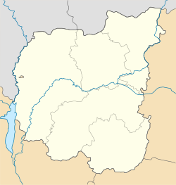
Mala Divytsia (Ukrainian: Мала Дівиця; Russian: Малая Девица) is a rural settlement in Pryluky Raion, Chernihiv Oblast, northern Ukraine. It hosts the administration of Mala Divytsia settlement hromada, one of the hromadas of Ukraine.[2] Population: 1,931 (2022 estimate).[1]
Mala Divytsia is located on the banks of the Halka River, a left tributary of the Uday, close to its mouth.
Until 26 January 2024, Mala Divytsia was designated urban-type settlement. On this day, a new law entered into force which abolished this status, and Mala Divytsia became a rural settlement.[3]
Economy
[edit]Transportation
[edit]Halka railway station on the line connecting Nizhyn and Pryluky is located in Mala Divytsia. There is some passenger traffic.
Mala Divytsia is next to P-67 road connecting Nizhyn and Pyriatyn via Pryluky. It also have access to H07 highway which connects Kyiv and Sumy.
References
[edit]- ^ a b Чисельність наявного населення України на 1 січня 2022 [Number of Present Population of Ukraine, as of January 1, 2022] (PDF) (in Ukrainian and English). Kyiv: State Statistics Service of Ukraine. Archived (PDF) from the original on 4 July 2022.
- ^ "Малодивицкая громада" (in Russian). Портал об'єднаних громад України.
- ^ "Что изменится в Украине с 1 января". glavnoe.in.ua (in Russian). 1 January 2024.


