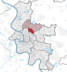
Mörsenbroich
Appearance

Mörsenbroich is an urban quarter of Düsseldorf, part of Borough 6. It borders on Unterrath, Rath, Derendorf, Grafenberg and Düsselthal. It has an area of 2.64 km2 (1.02 sq mi),[1] and 18,021 inhabitants (2020).[2]

In the region around Düsseldorf is the "Mörsenbroicher Ei" ("Mörsenbroich egg") well-known, because there is large traffic-jam every morning. The Mörsenbroich egg is a place where the federal highway A 52 ends and the traffic goes into the city of Düsseldorf. It crosses the federal road B 7, and two main roads of Düsseldorf, one of them is the ring road going along outside the central district of Düsseldorf.
References
[edit]- ^ "Stadtgebietsprofile - Stadtbezirke und Stadtteile 03 Geografie" (PDF). Landeshauptstadt Düsseldorf. Retrieved 4 November 2022.
- ^ "Stadtgebietsprofile - Stadtbezirke und Stadtteile 05 Bevölkerung" (PDF). Landeshauptstadt Düsseldorf. Retrieved 4 November 2022.
Wikimedia Commons has media related to Mörsenbroich.
51°15′19″N 6°48′29″E / 51.25528°N 6.80806°E

