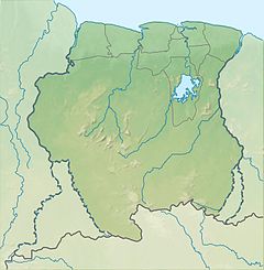
Lucie River
Appearance
| Lucie River | |
|---|---|
| Location | |
| Country | Suriname |
| District | Sipaliwini District |
| Physical characteristics | |
| Source | Eilerts de Haan Mountains |
| • location | 3°34′42″N 56°14′45″W / 3.5782°N 56.2459°W |
| Mouth | Courantyne River |
• location | 3°34′08″N 57°41′02″W / 3.5690°N 57.6838°W |
| Basin features | |
| Progression | Courantyne River→Atlantic Ocean |
Lucie River is a river of Suriname. It feeds into the Atlantic Ocean as well as the Courantyne River. The river was discovered and named by Eilerts de Haan in 1908.[1] Eilerts de Haan is buried near the river.[2]
See also
[edit]Notes
[edit]- ^ "3 oktober jarig: Dirk van Hogendorp, Johan Eilerts de Haan en Louis Aragon". Is Geschiedenis (in Dutch). Retrieved 29 May 2020.
- ^ "Encyclopaedie van Nederlandsch West-Indië - page 280 - Eilerts de Haan" (PDF). Digital Library for Dutch Literature (in Dutch). 1916. Retrieved 30 May 2020.
References
[edit]- Rand McNally, The New International Atlas, 1993.

