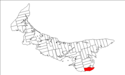
Lot 63, Prince Edward Island
Appearance
Lot 63, Prince Edward Island | |
|---|---|
Township | |
 Map of Prince Edward Island highlighting Lot 63 | |
| Coordinates: 46°3′N 62°35′W / 46.050°N 62.583°W | |
| Country | Canada |
| Province | Prince Edward Island |
| County | Kings County |
| Parish | St. Andrew's Parish |
| Area | |
| • Total | 103.01 km2 (39.77 sq mi) |
| Population (2006)[1] | |
| • Total | 901 |
| • Density | 8.7/km2 (23/sq mi) |
| Time zone | UTC-4 (AST) |
| • Summer (DST) | UTC-3 (ADT) |
| Canadian Postal code | C0A |
| Area code | 902 |
| NTS Map | 011L02 |
| GNBC Code | BAESX |
Lot 63 is a township in Kings County, Prince Edward Island, Canada. It is part of St. Andrew's Parish. Lot 63 was awarded to Hugh Palliser in the 1767 land lottery.[2]
References
[edit]- ^ a b Stats Canada 2001
- ^ Clark, Andrew Hill (1959). Three Centuries and the Island. Toronto Press. pp. Appendix B.
