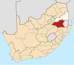
Lochiel, Mpumalanga
Appearance
Lochiel
Lohiya | |
|---|---|
| Coordinates: 26°08′10″S 30°47′10″E / 26.136°S 30.786°E | |
| Country | South Africa |
| Province | Mpumalanga |
| District | Gert Sibande |
| Municipality | Albert Luthuli |
| Area | |
| • Total | 8.01 km2 (3.09 sq mi) |
| Population (2001)[1] | |
| • Total | 2,805 |
| • Density | 350/km2 (910/sq mi) |
| Racial makeup (2001) | |
| • Black African | 99.6% |
| • Coloured | 0.4% |
| First languages (2001) | |
| • Swazi | 83.5% |
| • Zulu | 14.6% |
| • Afrikaans | 0.8% |
| • Sotho | 0.5% |
| • Other | 0.6% |
| Time zone | UTC+2 (SAST) |
| Postal code (street) | 2337 |
| PO box | 2337 |
Lochiel is a small forestry town in Gert Sibande District Municipality in the Mpumalanga province of South Africa. It lies near the border with Eswatini.
References
[edit]- ^ a b c d "Sub Place Lochiel". Census 2001.


