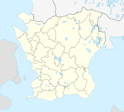
Ljungbyhed
Appearance
Ljungbyhed | |
|---|---|
| Coordinates: 56°04′N 13°13′E / 56.067°N 13.217°E | |
| Country | Sweden |
| Province | Skåne |
| County | Skåne County |
| Municipality | Klippan Municipality |
| Area | |
• Total | 2.97 km2 (1.15 sq mi) |
| Population (31 December 2010)[1] | |
• Total | 2,046 |
| • Density | 689/km2 (1,780/sq mi) |
| Time zone | UTC+1 (CET) |
| • Summer (DST) | UTC+2 (CEST) |
Ljungbyhed is a locality situated in Klippan Municipality, Skåne County, Sweden, with 2,046 inhabitants in 2010.[1]
History
[edit]Ljungbyhed was and is located in Riseberga socken and was part of the Riseberga landskommun after the municipal reform of 1862. In this, Ljungbyheds municipalsamhälle was established on 21 December 1934, which was then dissolved on 31 December 1962.[2]
Ljungbyhed was training ground for the North Scanian Infantry Regiment until 1923 and for the Scanian cavalry regiments. From 1925, Ljungbyhed became location for the 5th Air School Corps (5:e flygskolekåren).[3] From 1926 to 1998, the Swedish Air Force Flying School was located in Ljungbyhed.
References
[edit]- ^ a b c "Tätorternas landareal, folkmängd och invånare per km2 2005 och 2010" (in Swedish). Statistics Sweden. 14 December 2011. Archived from the original on 27 January 2012. Retrieved 10 January 2012.
- ^ Andersson, Per (1993). Sveriges kommunindelning 1863-1993 (in Swedish). Mjölby: Draking. ISBN 918778405X. SELIBR 7766806.
- ^ Carlquist, Gunnar, ed. (1937). Svensk uppslagsbok (in Swedish). Vol. 17. Malmö: Baltiska förl. p. 476. SELIBR 1335380.


