Liubsha Air Base
Appearance
This article needs additional citations for verification. (August 2021) |
Lyubsha | |||||||||||
|---|---|---|---|---|---|---|---|---|---|---|---|
| Summary | |||||||||||
| Airport type | Military | ||||||||||
| Operator | Ukrainian Air Force | ||||||||||
| Location | Kalush, Ukraine | ||||||||||
| Elevation AMSL | 807 ft / 246 m | ||||||||||
| Coordinates | 49°17′18″N 024°11′54″E / 49.28833°N 24.19833°E | ||||||||||
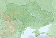
| Map | |||||||||||
 | |||||||||||
| Runways | |||||||||||
| |||||||||||
 | |||||||||||
Lyubsha was an air base in Ukraine located 32 km north of Kalush. It was located south of Lviv near the Polish-Slovak border. It appeared to be a forward staging base. One poorly maintained and small parallel taxiway, and a small ramp were located on the airfield.
History
[edit]In the 1970s, aviators of the 179th Fighter Aviation Regiment practiced landing Sukhoi Su-9s at the advanced deployment airfield in Lubsha.[1]
References
[edit]- ^ "Читать онлайн "Авиация и время 1998 06" - RuLit - Страница 11". www.rulit.me (in Russian). Retrieved August 29, 2021.


