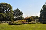
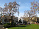
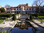
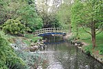
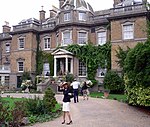
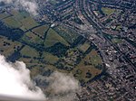
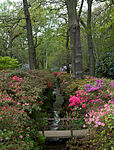
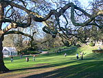
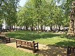
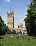
Listed parks and gardens in Greater London
Appearance
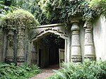
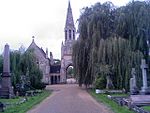
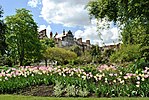
The Register of Historic Parks and Gardens of Special Historic Interest in England, created in 1983, is administered by Historic England. It includes more than 1,600 sites, ranging from gardens of private houses, to cemeteries and public parks.[1]
There are 168 registered parks and gardens in Greater London. 18 are listed at grade I, the highest grade, 32 at grade II*, the middle grade, and 118 at grade II, the lowest grade.
There are no listed parks and gardens in the London Borough of Barking and Dagenham, the Royal Borough of Kingston upon Thames or the London Borough of Waltham Forest.
Key
[edit]| Grade | Criteria[2] |
|---|---|
| I | Parks and gardens of exceptional interest, sometimes considered to be internationally important |
| II* | Particularly important parks and gardens of more than special interest |
| II | Parks and gardens of national importance and special interest |
Parks and gardens
[edit]Barnet
[edit]| Name | Grade | Location | Type | Completed [note 1] | Grid ref.[note 2] Geo-coordinates |
Entry number [note 3] | Image |
|---|---|---|---|---|---|---|---|
| Wrotham Park | II
|
Hadley | Landscape park | Early 19th century | TQ2448998979 | 1000254 | 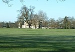 |
| East Finchley Cemetery | II*
|
East Finchley | Cemetery | 1855 | TQ 25913 89605 | 1000835 |  |
| Avenue House Grounds | II
|
Church End | Public park | 1880s | TQ 25212 90274 | 1001430 |  |
| Golders Green Crematorium | I
|
Golders Green | Crematorium | 1902 | TQ 25360 87961 | 1001575 | 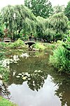 |
| St Pancras and Islington Cemetery | II*
|
East Finchley | Cemetery | 1854 | TQ 27218 90615 | 1001688 | 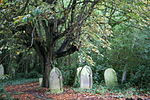 |
| Hoop Lane Jewish Cemetery | II
|
Golders Green | Cemetery | 1896 | TQ2521788071 | 1465310 | 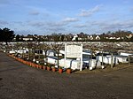 |
Bexley
[edit]| Name | Grade | Location | Type | Completed [note 1] | Grid ref.[note 2] Geo-coordinates |
Entry number [note 3] | Image |
|---|---|---|---|---|---|---|---|
| Danson Park | II
|
Welling | Public park | 1760s | TQ4710575029 | 1000211 | 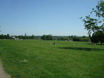 |
| Hall Place | II
|
Bexley | Garden | 1920s | TQ 50240 74176 | 1000247 |  |
| Foots Cray Place | II
|
Foots Cray | Park and garden | 1903 | TQ4740971818 | 1000288 |  |
| Lamorbey Park | II
|
Sidcup | Park and gardens | Early 20th century | TQ4669873240 | 1000289 | 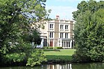 |
Brent
[edit]| Name | Grade | Location | Type | Completed [note 1] | Grid ref.[note 2] Geo-coordinates |
Entry number [note 3] | Image |
|---|---|---|---|---|---|---|---|
| Paddington Cemetery | II
|
Kilburn | Cemetery | 1855 | TQ 24562 83752 | 1001542 |  |
| Roundwood Park | II
|
Willesden | Public park | 1895 | TQ 22142 84043 | 1001556 | 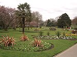 |
| Willesden Jewish Cemetery | II
|
Willesden | Cemetery | 1873 | TQ2210484425 | 1449184 |  |
Bromley
[edit]| Name | Grade | Location | Type | Completed [note 1] | Grid ref.[note 2] Geo-coordinates |
Entry number [note 3] | Image |
|---|---|---|---|---|---|---|---|
| Down House | II
|
Downe | Garden | 1846 | TQ 43074 60729 | 1000358 |  |
| Crystal Palace Park | II*
|
Crystal Palace | Public park | 1855 | TQ 34298 70925 | 1000373 |  |
| Holwood Park | II
|
Keston | Landscape park | 1798 | TQ4210863862 | 1000812 |  |
| Sundridge Park | II
|
Sundridge | Landscape park | Late 18th century | TQ 41632 70630 | 1000841 |  |
| Priory Gardens | II
|
Orpington | Public park | Late 19th century | TQ 46649 66680 | 1001444 | 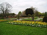 |
Camden
[edit]City of London
[edit]| Name | Grade | Location | Type | Completed [note 1] | Grid ref.[note 2] Geo-coordinates |
Entry number [note 3] | Image |
|---|---|---|---|---|---|---|---|
| Finsbury Circus | II
|
Finsbury | Garden square | 1817 | TQ 32865 81616 | 1001259 | 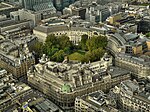 |
| Middle Temple | II
|
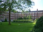
Temple | Garden | 1682 | TQ 31144 80848 | 1001453 |  |
| The Barbican | II*
|
Cripplegate | Housing estate grounds | 1982 | TQ 32349 81831 | 1001668 |  |
| Golden Lane Estate | II
|
Finsbury | Housing estate grounds | 1962 | TQ3217482109 | 1468840 |  |
Croydon
[edit]| Name | Grade | Location | Type | Completed [note 1] | Grid ref.[note 2] Geo-coordinates |
Entry number [note 3] | Image |
|---|---|---|---|---|---|---|---|
| Addington Palace | II
|
Addington | Private park | 1780s | TQ3661164521 | 1000790 | 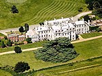 |
| Norwood Grove | II
|
Upper Norwood | Public park | 1926 | TQ 31195 70599 | 1000823 | 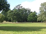 |
| Promenade de Verdun Memorial Landscape | II
|
Purley | Memorial garden | 1922 | TQ2980661612 | 1431287 |  |
Ealing
[edit]| Name | Grade | Location | Type | Completed [note 1] | Grid ref.[note 2] Geo-coordinates |
Entry number [note 3] | Image |
|---|---|---|---|---|---|---|---|
| Walpole Park | II
|
Ealing | Public park | 1902 | TQ 17397 80242 | 1000847 |  |
| City of Westminster Cemetery | II
|
Hanwell | Cemetery | 1854 | TQ 15922 80004 | 1001543 |  |
| Royal Borough of Kensington and Chelsea Cemetery | II
|
Hanwell | Cemetery | 1855 | TQ 15835 80466 | 1001544 | 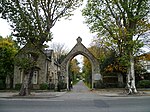 |
Enfield
[edit]| Name | Grade | Location | Type | Completed [note 1] | Grid ref.[note 2] Geo-coordinates |
Entry number [note 3] | Image |
|---|---|---|---|---|---|---|---|
| Myddelton House | II
|
Enfield | Garden | 1954 | TQ 34142 99219 | 1000243 |  |
| Grovelands Park | II*
|
Southgate | Landscape park | Late 18th century | TQ 30527 94308 | 1000395 |  |
| Trent Park | II
|
Cockfosters | Landscape park | Late 18th century | TQ 28735 97589 | 1000484 |  |
| Broomfield House | II
|
Palmers Green | Park and garden | Early 18th century | TQ 30412 92729 | 1000517 |  |
| Forty Hall | II
|
Forty Hill | Park and garden | Late 18th century | TQ 33757 98731 | 1001357 |  |
Greenwich
[edit]| Name | Grade | Location | Type | Completed [note 1] | Grid ref.[note 2] Geo-coordinates |
Entry number [note 3] | Image |
|---|---|---|---|---|---|---|---|
| Greenwich Park | I
|
Greenwich | Public park | 1660s | TQ 39063 77268 | 1000174 | 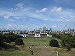 |
| Well Hall Pleasaunce | II
|
Well Hall | Public park | 1936 | TQ 42425 75040 | 1000850 | 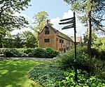 |
| Eltham Palace | II*
|
Eltham | Garden | 1935 | TQ 42461 73950 | 1001410 | 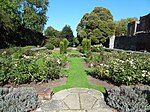 |
| Repository Woods | II
|
Woolwich | Military training area | 1800s | TQ4251178100 | 1001717 |  |
Hackney
[edit]| Name | Grade | Location | Type | Completed [note 1] | Grid ref.[note 2] Geo-coordinates |
Entry number [note 3] | Image |
|---|---|---|---|---|---|---|---|
| Abney Park Cemetery | II
|
Stoke Newington | Cemetery | 1840 | TQ 33400 86830 | 1000789 |  |
| Clissold Park | II
|
Stoke Newington | Public park | 1889 | TQ 32643 86470 | 1000800 |  |
| Springfield Park | II
|
Upper Clapton | Public park | 1905 | TQ 34629 87518 | 1000839 |  |
Hammersmith and Fulham
[edit]| Name | Grade | Location | Type | Completed [note 1] | Grid ref.[note 2] Geo-coordinates |
Entry number [note 3] | Image |
|---|---|---|---|---|---|---|---|
| Fulham Palace | II*
|
Fulham | Garden | 1760s | TQ 24118 76201 | 1000133 |  |
| St Peter's Square | II
|
Hammersmith | Garden square | 1830 | TQ 22003 78455 | 1000837 |  |
| Bishops Park | II
|
Fulham | Public park | 1893 | TQ 23951 76058 | 1001677 | 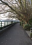 |
Haringey
[edit]| Name | Grade | Location | Type | Completed [note 1] | Grid ref.[note 2] Geo-coordinates |
Entry number [note 3] | Image |
|---|---|---|---|---|---|---|---|
| Finsbury Park | II
|
Finsbury Park | Public park | 1869 | TQ 31719 87513 | 1000804 |  |
| Alexandra Palace | II
|
Wood Green | Public park | 1863 | TQ 29667 89984 | 1001253 | 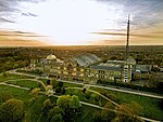 |
Harrow
[edit]| Name | Grade | Location | Type | Completed [note 1] | Grid ref.[note 2] Geo-coordinates |
Entry number [note 3] | Image |
|---|---|---|---|---|---|---|---|
| Grim's Dyke | II
|
Harrow Weald | Garden | 1870s | TQ 14077 92924 | 1001254 | 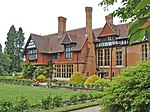 |
| Canons Park | II
|
Stanmore | Public park | 1938 | TQ1813691988 | 1001394 | 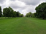 |
| Harrow Park | II
|
Harrow on the Hill | Landscape park | 1771 | TQ1532886993 | 1001424 |  Upload Photo |
| Bentley Priory | II
|
Stanmore | Landscape park | Early 19th century | TQ 15582 92885 | 1001440 | 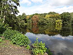 |
Havering
[edit]| Name | Grade | Location | Type | Completed [note 1] | Grid ref.[note 2] Geo-coordinates |
Entry number [note 3] | Image |
|---|---|---|---|---|---|---|---|
| Upminster Court | II
|
Upminster | Garden | 1900s | TQ 56365 87962 | 1001586 | 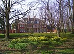 |
Hillingdon
[edit]| Name | Grade | Location | Type | Completed [note 1] | Grid ref.[note 2] Geo-coordinates |
Entry number [note 3] | Image |
|---|---|---|---|---|---|---|---|
| Harefield Place | II
|
Harefield | Garden | 17th century | TQ 05440 89483 | 1001525 |  Upload Photo |
| Stockley Park | II
|
Hayes | Business park | 1993 | TQ0791680469 | 1466074 | 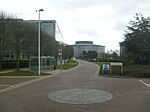 |
Hounslow
[edit]| Name | Grade | Location | Type | Completed [note 1] | Grid ref.[note 2] Geo-coordinates |
Entry number [note 3] | Image |
|---|---|---|---|---|---|---|---|
| Chiswick House | I
|
Chiswick | Garden | 1720s | TQ2083077489 | 1000111 | 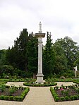 |
| Syon Park | I
|
Isleworth | Garden | Mid 18th century | TQ 17232 76641 | 1000148 |  |
| Osterley Park | II*
|
Osterley | Park and garden | 1760s | TQ 14414 78372 | 1000287 | 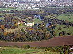 |
| Gunnersbury Park | II*
|
Gunnersbury | Garden | Late 18th century | TQ 18761 78931 | 1000808 |  |
| Strawberry House | II
|
Chiswick | Garden | 1924 | TQ 21859 78091 | 1000840 |  Upload Photo |
| Walpole House | II
|
Chiswick | Garden | 1920s | TQ 21835 78082 | 1000846 |  Upload Photo |
Islington
[edit]| Name | Grade | Location | Type | Completed [note 1] | Grid ref.[note 2] Geo-coordinates |
Entry number [note 3] | Image |
|---|---|---|---|---|---|---|---|
| Bunhill Fields Burial Ground | I
|
Finsbury | Cemetery | 1666 | TQ 32693 82267 | 1001713 | 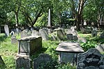 |
Kensington and Chelsea
[edit]Lambeth
[edit]| Name | Grade | Location | Type | Completed [note 1] | Grid ref.[note 2] Geo-coordinates |
Entry number [note 3] | Image |
|---|---|---|---|---|---|---|---|
| Brockwell Park | II
|
Herne Hill | Public park | 1892 | TQ 31658 74036 | 1000794 |  |
| Kennington Park | II
|
Kennington | Public park | 1854 | TQ 31411 77704 | 1000816 | 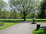 |
| Lambeth Palace | II
|
Lambeth | Garden | 1920s | TQ 30673 79175 | 1000818 | 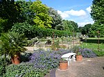 |
| Myatt's Fields | II
|
Camberwell | Public park | 1889 | TQ 31817 76701 | 1000822 | 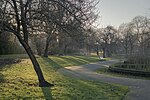 |
| The Rookery | II
|
Streatham Common | Public park | 1913 | TQ 30929 70835 | 1000829 |  |
| Ruskin Park | II
|
Camberwell | Public park | 1910 | TQ 32503 75749 | 1000831 | 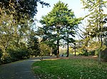 |
| St Michael's Convent | II
|
Streatham | Garden | Mid 19th century | TQ 31027 71177 | 1000836 |  Upload Photo |
| West Norwood Cemetery and Crematorium | II*
|
West Norwood | Cemetery | 1837 | TQ 32249 72131 | 1000851 |  |
Lewisham
[edit]| Name | Grade | Location | Type | Completed [note 1] | Grid ref.[note 2] Geo-coordinates |
Entry number [note 3] | Image |
|---|---|---|---|---|---|---|---|
| Horniman Gardens | II
|
Forest Hill | Public park | 1930 | TQ 34811 73217 | 1000813 | 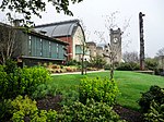 |
| Manor House Gardens | II
|
Lee | Public park | 1770s | TQ 39433 74889 | 1000821 | 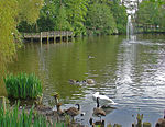 |
| Grove Park Cemetery | II
|
Grove Park | Cemetery | 1935 | TQ 41680 71535 | 1001681 | 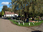 |
Merton
[edit]| Name | Grade | Location | Type | Completed [note 1] | Grid ref.[note 2] Geo-coordinates |
Entry number [note 3] | Image |
|---|---|---|---|---|---|---|---|
| Cannizaro Park | II*
|
Wimbledon | Public park | Early 18th century | TQ 23097 70664 | 1000797 |  |
| Morden Hall Park | II
|
Morden | Park and garden | 1870s | TQ 26230 68244 | 1001336 | 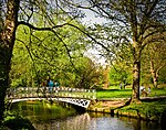 |
| South Park Gardens | II
|
Wimbledon | Public park | 1889 | TQ 25331 70782 | 1001398 | 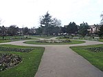 |
Newham
[edit]| Name | Grade | Location | Type | Completed [note 1] | Grid ref.[note 2] Geo-coordinates |
Entry number [note 3] | Image |
|---|---|---|---|---|---|---|---|
| City of London Cemetery | I
|
Aldersbrook | Cemetery | 1857 | TQ 42257 86441 | 1000286 | 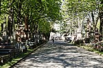 |
| West Ham Park | II
|
West Ham | Public park | 1887 | TQ 40038 84268 | 1001685 | 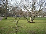 |
Redbridge
[edit]| Name | Grade | Location | Type | Completed [note 1] | Grid ref.[note 2] Geo-coordinates |
Entry number [note 3] | Image |
|---|---|---|---|---|---|---|---|
| Wanstead Park | II*
|
Wanstead | Public park | 1818 | TQ4104087270 | 1000194 |  Upload Photo |
| Valentines Park | II
|
Gants Hill | Public park | 1907 | TQ 43606 87640 | 1000843 |  |
Richmond upon Thames
[edit]Southwark
[edit]| Name | Grade | Location | Type | Completed [note 1] | Grid ref.[note 2] Geo-coordinates |
Entry number [note 3] | Image |
|---|---|---|---|---|---|---|---|
| Dulwich Park | II
|
Dulwich | Public park | 1890 | TQ 33615 73600 | 1000416 |  |
| Belair | II
|
West Dulwich | Public park | 1785 | TQ 32767 73305 | 1000791 | 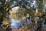 |
| Nunhead Cemetery | II*
|
Nunhead | Cemetery | 1840 | TQ 35454 75571 | 1000824 |  |
| Peckham Rye Park | II
|
Peckham | Public park | 1894 | TQ 34890 74840 | 1000825 |  |
| Southwark Park | II
|
Rotherhithe | Public park | 1869 | TQ 35191 78949 | 1000838 | 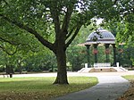 |
Sutton
[edit]| Name | Grade | Location | Type | Completed [note 1] | Grid ref.[note 2] Geo-coordinates |
Entry number [note 3] | Image |
|---|---|---|---|---|---|---|---|
| Carshalton House | II
|
Carshalton | Garden | 1720 | TQ 27596 64458 | 1000798 |  |
| Nonsuch Park | II
|
Cheam | Park and Garden | Late 18th century | TQ 23091 63767 | 1001672 |  |
Tower Hamlets
[edit]| Name | Grade | Location | Type | Completed [note 1] | Grid ref.[note 2] Geo-coordinates |
Entry number [note 3] | Image |
|---|---|---|---|---|---|---|---|
| Victoria Park | II*
|
Bethnal Green | Public park | 1845 | TQ3627283847 | 1000178 | 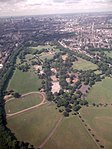 |
| Island Gardens | II
|
Millwall | Public park | 1895 | TQ 38400 78331 | 1000815 |  |
| Arnold Circus | II
|
Bethnal Green | Public park | 1900 | TQ 33643 82549 | 1001300 |  |
| Bethnal Green Gardens | II
|
Bethnal Green | Public park | 1875 | TQ 34960 82808 | 1001673 |  |
| The Novo Cemetery | II
|
Mile End | Cemetery | 1855 | TQ3612482436 | 1416421 |  |
Wandsworth
[edit]| Name | Grade | Location | Type | Completed [note 1] | Grid ref.[note 2] Geo-coordinates |
Entry number [note 3] | Image |
|---|---|---|---|---|---|---|---|
| Battersea Park | II*
|
Battersea | Public park | 1854 | TQ 28049 77164 | 1000283 |  |
| Wandsworth Park | II
|
Wandsworth | Public park | 1903 | TQ 24853 75245 | 1000285 |  |
| Grove House | II
|
Roehampton | Garden | Mid 18th century | TQ 21917 74314 | 1000419 | 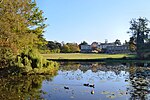 |
| Putney Vale Cemetery | II
|
Putney Vale | Cemetery | 1891 | TQ 22330 72643 | 1000827 | 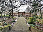 |
| Wimbledon Park | II*
|
Wimbledon | Public park | 1760s | TQ 24703 72394 | 1000852 |  |
| Springfield Hospital | II
|
Tooting | Hospital grounds | 1841 | TQ 27072 72561 | 1001601 |  |
| Landscaping to Alton West Estate | II
|
Roehampton | Housing estate grounds | 1961 | TQ2181974044 | 1466474 | 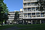 |
| Landscaping to Alton East Estate | II
|
Roehampton | Housing estate grounds | 1955 | TQ2254673311 | 1466474 |  Upload Photo |
Westminster
[edit]References
[edit]- ^ "Registered Parks & Gardens". Historic England. Retrieved 29 December 2022.
- ^ "Listed buildings: How are listed buildings graded?". Historic England.
Notes
[edit]- ^ a b c d e f g h i j k l m n o p q r s t u v w x y z aa ab ac ad The date given is the date used by Historic England as significant for the initial building or that of an important part in the structure's description.
- ^ a b c d e f g h i j k l m n o p q r s t u v w x y z aa ab ac ad Sometimes known as OSGB36, the grid reference is based on the British national grid reference system used by the Ordnance Survey.
- ^ a b c d e f g h i j k l m n o p q r s t u v w x y z aa ab ac ad The "List Entry Number" is a unique number assigned to each listed building and scheduled monument by Historic England.

