List of cultural heritage sites in Balochistan, Pakistan
Appearance
(Redirected from List of archaeological sites and monuments in Balochistan)
According to the Pakistan Environmental Protection Agency's report published on protected areas in 1997, Balochistan has 27 archaeological sites and monuments protected by the Federal Government.[1] These include the province's only national monument; Ziarat Residency. Additionally it has one site on the tentative world heritage list, Mehrgarh.[2]
Of the some 400 sites and monuments protected under the Antiquities Act 1975, the province contains seven sites in Category 1, eight in Category II and fourteen in Category III.[3]
National monuments, UNESCO inscribed and tentative sites
Federal Government
[edit]The following sites were previously protected under the Federal Government.
| ID | Name | Type | Location | District | Coordinates | Image |
|---|---|---|---|---|---|---|
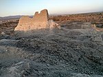
| BA-1 | Pirak mound | Village Kolachi — located 17 kilometres (11 mi) south of Sibi on the right side of the road to Jacobabad[4] | Sibi District |  | ||
| BA-2 | Nindo Damb | Ornach Valley, Tehsil Wadh | Killa Abdullah District |  Tunnel, Chaman&categories= Upload Photo | ||
| BA-3 | Fort wall of Jhalawar | Jhalawar | Kharan District |  Upload Photo | ||
| BA-4 | Fort of Azad Khan (Kharan Fort) | Kharan town | Kharan |  | ||
| BA-5 | Pally Kalat | Washbohi | Kharan |  | ||
| BA-6 | Nauroze Fort | Nauroze | Kharan |  Upload Photo | ||
| BA-7 | Ancient tomb | Jhalawar | Kharan |  | ||
| BA-8 | Har-o-Goke | Garuk | Kharan |  Upload Photo | ||
| BA-9 | Bara Bagh Cemetery, Lasbela | Babrs | Lasbela District |  | ||
| BA-10 | Tomb of General Muhammad Ibn-e-Haroon | Bela town | Lasbela |  Upload Photo | ||
| BA-11 | Tombs at Hinidan | Pir Mubarakm | Lasbela |  | ||
| BA-12 | Chowkhundi (Rumi) graves | Bhawani Sarai, 5 miles from Hub Chowki | Lasbela |  | ||
| BA-13 | Tordheri site | Tordheri | Loralai District |  Upload Photo | ||
| BA-14 | High mound | Dabarkot | Loralai |  Upload Photo | ||
| BA-15 | Prehistoric mound | Harian Haider Zai | Loralai |  | ||
| BA-16 | Damb Judeir or Judeir-jo-daro | Deh Jodher No. 2 between Jhat Pat and Dera Murad Jamali | Nasirabad District |  Upload Photo | ||
| BA-17 | Mound No. 1 in Killi Gul Muhammad | Village Kotwal — located 3 kilometres (1.9 mi) northwest of Quetta city on the left side of the road to Chaman[4] | Quetta District |  Upload Photo | ||
| BA-18 | Mound No. 2 | Village Samangali, west side of Airport | Quetta |  Upload Photo | ||
| BA-19 | Mound No. 3 in Damb Sadat | Located 13 kilometres (8.1 mi)southwest from Quetta city[4] | Quetta |  Upload Photo | ||
| BA-20 | Mound No. 5 in Ahmad Khanzai | Located 5 kilometres (3.1 mi) south of Quetta[4] | Quetta |  Upload Photo | ||
| BA-21 | Mound No. 6 | Shahi Khan, near Pir Ballo on Sariab Road | Quetta |  Upload Photo | ||
| BA-22 | Mound No. 7 | Kachlak on Chaman Road | Quetta |  Upload Photo | ||
| BA-23 | Mound No. 8 | Village Samali (Dosak-i-Khasyan) | Quetta |  Upload Photo | ||
| BA-24 | Mound No. 9 | Village Metar Zai | Quetta |  Upload Photo | ||
| BA-25 | Mound No. 10 | Shaikh Manda on Chaman Road | Quetta |  | ||
| BA-26 | Mound No. 11 | Village Vauhisar | Quetta |  Upload Photo | ||
| BA-27 | Quaid-i-Azam Residency Building | Ziarat | Ziarat District |  | ||
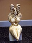
| BA-28 | Archaeological Site of Mehrgarh | Dhadar - located 18 kilometres (11 mi) southeast of Dhadar Town on the right bank of Bolan River[4] | Bolan District |  |
Unprotected sites and heritage
[edit]| ID | Name | Type | Location | District | Coordinates | Image |
|---|---|---|---|---|---|---|
| BA-U-1 | Bangi Ismail’s tomb (1468) | [5] | Gwadar |  Upload Photo | ||
| BA-U-2 | Jiwani graves c1400 AD | Jiwani[5] | Gwadar |  | ||
| BA-U-3 | Pasni graves c1400 AD | Pasni[5] | Gwadar |  Upload Photo | ||
| BA-U-4 | Sohbatpur Mosque (1940) | [5] | Jaffarabad |  Upload Photo | ||
| BA-U-5 | Kalatuk (Fort) c 1700 AD | [5] | Kech |  | ||
| BA-U-6 | Miri Qila (Miri Fort) | [5] | Kech |  | ||
| BA-U-7 | Nikoderian Tombs | in Mashkel, Nag and Panjgur[5] | Kharan & Panjgur |  Upload Photo | ||
| BA-U-8 | Khawaja Amran Shrine | Near Gulistan[6] | Killa Abdullah |  Upload Photo | ||
| BA-U-9 | Spin Ghundi Mound | Close to Habibzai Village at the foot of an offshoot of the Khawaja Amran Range[6] | Killa Abdullah |  Upload Photo | ||
| BA-U-10 | Gondrani (or Gundriani) | [7] | Lasbela |  | ||
| BA-U-11 | Shah Bilawal's Shrine | [8] | Khuzdar |  Upload Photo | ||
| BA-U-12 | Jamia Mosque c1838 | Bela[5] | Lasbela |  Upload Photo | ||
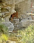
| BA-U-13 | Lahut-i-Lamakan (cave) | [8] | Khuzdar |  | ||
| BA-U-14 | Kumb Shrine | [8] | Lasbela |  Upload Photo | ||
| BA-U-15 | Shireen and Farhad (shrine) | [8] | Lasbela |  | ||
| BA-U-16 | Sassi and Punnu (shrine) | Mouza Mumbar, Tehsil Sonmiani[9] | Lasbela |  Upload Photo | ||
| BA-U-17 | Pir Fida Hussain's shrine | [8] | Lasbela |  Upload Photo | ||
| BA-U-18 | Pir Moosiani's shrine | [8] | Lasbela |  Upload Photo | ||
| BA-U-19 | Pir Mohiddin's shrine | [8] | Lasbela |  Upload Photo | ||
| BA-U-20 | Mai Gondrani's shrine | [8] | Lasbela |  Upload Photo | ||
| BA-U-21 | Shahi Jamia Mosque | Bela[9] | Lasbela |  Upload Photo | ||
| BA-U-22 | Sir Robert Sandeman's tomb | Bela[9] | Lasbela |  Upload Photo | ||
| BA-U-23 | Karia Pir's shrine | Bela[9] | Lasbela |  Upload Photo | ||
| BA-U-24 | Sassi's spring | [9] | Lasbela |  Upload Photo | ||
| BA-U-25 | Chinjan | 68 km southwest of Loralai[10] | Loralai |  | ||
| BA-U-26 | Daber Kot | 18km northeast of Duki Town[10] | Loralai |  Upload Photo | ||
| BA-U-27 | Mughal Qila (Mughal Fort) – c 1500AD | [5] | Loralai |  | ||
| BA-U-28 | Rana Ghundai | [10] | Loralai |  | ||
| BA-U-29 | Surjangal | 8km northeast of Sinjawi Town, Baghave Valley on road to Duki.[10] | Loralai |  | ||
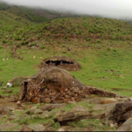
| BA-U-30 | Torghar — caves and rock shelters with paintings | Sulaiman Range[7] | Musakhel |  Upload Photo | ||
| BA-U-31 | Zuncari Village — rock shelters | Sulaiman Range[7] | Musakhel |  | ||
| BA-U-32 | Sara Qila (Sara Fort) | [5] | Pishin |  Upload Photo | ||
| BA-U-33 | Governor's House | [11] | Quetta |  | ||
| BA-U-34 | Balochistan Secretariate building | Quetta[11] | Quetta |  Upload Photo | ||
| BA-U-35 | Quetta railway station | Quetta[11] | Quetta |  | ||
| BA-U-36 | General Post Office and Central Telegraph Office building | Quetta[11] | Quetta |  Upload Photo | ||
| BA-U-37 | Sessions Courts building | Quetta[11] | Quetta |  | ||
| BA-U-38 | Balochistan High Court building | Quetta[11] | Quetta |  | ||
| BA-U-39 | Frontier Corps Headquarters | Quetta[12] | Quetta |  Upload Photo | ||
| BA-U-40 | Pakistan Command and Staff College (main building) | Quetta[12] | Quetta |  | ||
| BA-U-41 | Babar/Khosti - 10 rock shelters | Sulaiman Range[7] | Zhob |  Upload Photo | ||
| BA-U-42 | Badanzai | Bronze Age[10] | Zhob |  Upload Photo | ||
| BA-U-43 | Dhana Abdullahzai - 1 rock shelter - 1st time with wild boar | Sulaiman Range[7] | Zhob |  Upload Photo | ||
| BA-U-44 | Hazrat Nazar Nika's Shrine | 6 km from Zhob[13] | Zhob |  Upload Photo | ||
| BA-U-45 | Hazrat Khostu Baba's shrine | 100 km from Zhob towards Waziristan[13] | Zhob |  Upload Photo | ||
| BA-U-46 | Ismailzai | [10] | Zhob |  Upload Photo | ||
| BA-U-47 | Lakaha Band - 4 rock shelters | Sulaiman Range[7] | Zhob |  Upload Photo | ||
| BA-U-48 | Leaoha Ghozai - 5 caves and 6 rock shelters | Sulaiman Range[7] | Zhob |  Upload Photo | ||
| BA-U-49 | Mughal Ghundai | [10] | Zhob |  Upload Photo
| ||
| BA-U-50 | Musazai | [10] | Zhob |  Upload Photo | ||
| BA-U-51 | Palwan Baba's shrine | Mughalkot area[13] | Zhob |  Upload Photo | ||
| BA-U-52 | Paryan-o-Ghundi (or Periano Ghundai) (destroyed) | 2 miles west of Zhob[14][10] | Zhob |  Upload Photo | ||
| BA-U-53 | Qais Rashid's tomb | top of Suleman Mountain[13] | Zhob |  Upload Photo | ||
| BA-U-54 | Zakoo Nika's shrine | near Zhob[13] | Zhob |  Upload Photo | ||
| BA-U-55 | Walli Tangi waterfall | Quetta | Quetta |  | ||
| BA-U-56 | Khojak Tunnel | near Pak-Afghan border at Chamman | Killa Abdullah |  | ||
| BA-U-57 | Hinglaj Mata (Rani ki Mandir) | Hinglaj | Lasbela |  | ||
| BA-U-58 | Lakho Pir | Near Bareja, 3 Kilometer from Khuzdar-Shahdadkot Highway | Jhal Magsi |  Upload Photo | ||
| BA-U-59 | Shahli Tomb (Shrine) | Usta Muhammad, 2 Kilometer from Faizabad Usta Muhammad Road | Jaffarabad |  Upload Photo | ||
| BA-U-60 | Gadahi Tomb (Shrine) | Usta Muhammad, 3 Kilometer from Faizabad-Usta Muhammad Road | Jaffarabad |  Upload Photo | ||
| BA-U-61 | Suhryani Tomb (Shrine) | Usta Muhammad, 5 Kilometer from Faizabad-Usta Muhammad Road | Jaffarabad |  Upload Photo |
Further reading
[edit]- Balochistan Conservation Strategy - IUCN Archived 2015-04-28 at the Wayback Machine
Wikimedia Commons has media related to Cultural heritage monuments in Balochistan (Pakistan).
References
[edit]- ^ "List of Protected Notified Archaeological Sites and Monuments in Pakistan" (PDF). Pakistan Environmental Protection Agency. pp. 47–48. Archived from the original (PDF) on 14 October 2013. Retrieved 11 May 2014.
- ^ "Archaeological Site of Mehrgarh". UNESCO World Heritage Center. Retrieved 11 May 2014.
- ^ 400 Monuments, Sites protected under Antiquities Act The Nation 9 July 2012. Retrieved 17 May 2014
- ^ a b c d e iucn. "Pre-Historic Caves and Rock Shelter Dwellings" (PDF). Balochistan Conservation Strategy. IUCN. p. 192. Archived from the original (PDF) on 28 April 2015. Retrieved 11 May 2014.
- ^ a b c d e f g h i j Balochistan Conservation Strategy IUCN Pakistan and Government of Balochistan 2000 ISBN 969-8141-33-2 pg 194. Retrieved 19 May 2014
- ^ a b Important/Historical Places, 1998 District Census Report of Killa Abdullah. Population Census Organisation, Government of Pakistan 2000 pg 11
- ^ a b c d e f g Balochistan Conservation Strategy IUCN Pakistan and Government of Balochistan 2000 ISBN 969-8141-33-2 pg 190. Retrieved 19 May 2014
- ^ a b c d e f g h Important/Historical Places, 1998 District Census Report of Lasbella. Population Census Organisation, Government of Pakistan 1999 pg 16
- ^ a b c d e Important/Historical Places, 1998 District Census Report of Lasbella. Population Census Organisation, Government of Pakistan 1999 pg 17
- ^ a b c d e f g h i Balochistan Conservation Strategy IUCN Pakistan and Government of Balochistan 2000 ISBN 969-8141-33-2 pg 191. Retrieved 19 May 2014
- ^ a b c d e f Important/Historical Places, Quetta City in 1998 District Census Report of Quetta, Population Census Organisation, Government of Pakistan 2001 pg 11
- ^ a b Important/Historical Places, Quetta City in 1998 District Census Report of Quetta, Population Census Organisation, Government of Pakistan 2001 pg 12
- ^ a b c d e Important/Historical Places, 1998 District Census Report of Zhob, Population Census Organisation, Government of Pakistan 2000 pg 12
- ^ Important/Historical Places, 1998 District Census Report of Zhob, Population Census Organisation, Government of Pakistan 2000 pg 13

