List of sovereign states and dependent territories in North America
Appearance
(Redirected from List of North American countries and territories)
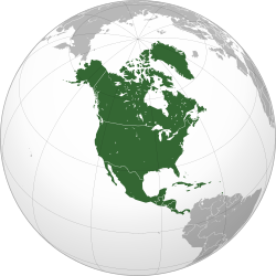
The following is a list of sovereign countries and dependent territories in North America, a continent that covers the landmass north of the Colombia-Panama border as well as the islands of the Caribbean.
Sovereign states
[edit]All of the states listed here are member states of the United Nations.
| Flag | Map | English short, formal names, and ISO [1][2][3][4] |
Domestic short and formal name(s) [1][2] |
Capital [3][5][6] |
Population 2021 [7][8] |
Area [9] |
Currency [3] |
|---|---|---|---|---|---|---|---|

|

|
Antigua and Barbuda[n 1] ATG |
English: Antigua and Barbuda | St. John's | 93,219 | 442.6 km2 (171 sq mi) | East Caribbean dollar |

|
|
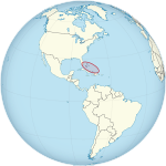
The Bahamas[n 1] Commonwealth of The Bahamas BHS |
English: The Bahamas—Commonwealth of The Bahamas | Nassau | 407,906 | 13,940 km2 (5,382 sq mi) | Bahamian dollar |

|

|
Barbados[n 1] BRB |
English: Barbados | Bridgetown | 281,200 | 431 km2 (166 sq mi) | Barbadian dollar |

|
|
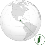
Belize[n 1][n 2] BLZ |
English: Belize | Belmopan | 400,031 | 22,966 km2 (8,867 sq mi) | Belize dollar |

|

|
Canada[n 3] CAN |
English: Canada French: Canada |
Ottawa | 38,155,012 | 9,984,670 km2 (3,855,103 sq mi) | Canadian dollar |

|

|
Costa Rica[n 2] Republic of Costa Rica CRI |
Spanish: Costa Rica — República de Costa Rica | San José | 5,153,957 | 51,100 km2 (19,730 sq mi) | Costa Rican colón |

|
|
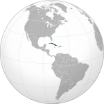
Cuba Republic of Cuba CUB |
Spanish: Cuba — República de Cuba | Havana | 11,256,372 | 110,860 km2 (42,803 sq mi) | Cuban peso Cuban convertible peso |

|

|
Dominica[n 1] Commonwealth of Dominica DMA |
English: Dominica — Commonwealth of Dominica | Roseau | 72,412 | 754 km2 (291 sq mi) | East Caribbean dollar |

|
|
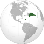
Dominican Republic[n 2] DOM |
English: Dominican Republic Spanish: República Dominicana |
Santo Domingo | 11,117,873 | 48,730 km2 (18,815 sq mi) | Dominican peso |

|

|
El Salvador[n 2] Republic of El Salvador SLV |
English: El Salvador — Republic of El Salvador Spanish: El Salvador — República de El Salvador |
San Salvador | 6,314,167 | 21,040 km2 (8,124 sq mi) | United States dollar |

|

|
Grenada[n 1] GRD |
English: Grenada | St. George's | 124,610 | 344 km2 (133 sq mi) | East Caribbean dollar |

|

|
Guatemala[n 2] Republic of Guatemala GTM |
Spanish: Guatemala — República de Guatemala | Guatemala City | 17,608,483 | 108,890 km2 (42,043 sq mi) | Guatemalan quetzal |

|

|
Haiti[n 1] Republic of Haiti HTI |
French: Haïti — République d'Haïti Haitian Creole: Ayiti — Repiblik d Ayiti |
Port-au-Prince | 11,447,569 | 27,750 km2 (10,714 sq mi) | Haitian gourde |

|

|
Honduras[n 2] Republic of Honduras HND |
Spanish: Honduras — República de Honduras | Tegucigalpa | 10,278,345 | 112,090 km2 (43,278 sq mi) | Honduran lempira |

|

|
Jamaica[n 1] JAM |
English: Jamaica | Kingston | 2,827,695 | 10,991 km2 (4,244 sq mi) | Jamaican dollar |

|

|
Mexico[n 3] United Mexican States MEX |
Spanish: México — Estados Unidos Mexicanos | Mexico City | 126,705,138 | 1,972,550 km2 (761,606 sq mi) | Mexican peso |

|

|
Nicaragua[n 2] Republic of Nicaragua NIC |
Spanish: Nicaragua — República de Nicaragua | Managua | 6,850,540 | 129,494 km2 (49,998 sq mi) | Nicaraguan córdoba |

|

|
Panama[n 2] Republic of Panama PAN |
English: Panama — Republic of Panama Spanish: Panamá — República de Panamá |
Panama City | 4,351,267 | 78,200 km2 (30,193 sq mi) | Panamanian balboa United States dollar |

|

|
Saint Kitts and Nevis[n 1] Federation of Saint Kitts and Nevis KNA |
English: Saint Kitts and Nevis — Federation of Saint Kitts and Nevis | Basseterre | 47,606 | 261 km2 (101 sq mi) | East Caribbean dollar |

|

|
Saint Lucia[n 1] LCA |
English: Saint Lucia | Castries | 179,651 | 616 km2 (238 sq mi) | East Caribbean dollar |

|

|
Saint Vincent and the Grenadines[n 1] VCT |
English: Saint Vincent and the Grenadines | Kingstown | 104,332 | 389 km2 (150 sq mi) | East Caribbean dollar |

|

|
Trinidad and Tobago[n 1] Republic of Trinidad and Tobago TTO |
English: Trinidad and Tobago — Republic of Trinidad and Tobago | Port of Spain | 1,525,663 | 5,128 km2 (1,980 sq mi) | Trinidad and Tobago dollar |

|

|
United States[n 3] United States of America USA |
English: United States of America | Washington, D.C | 336,997,624 | 9,826,630 km2 (3,794,083 sq mi) | United States dollar |
Non-sovereign territories
[edit]This section contains areas that are not sovereign states nor integral parts of the sovereign states listed above. These include dependent territories and integral areas of primarily non-North American states.
Dependent territories
[edit]Dependencies that are not internationally recognized, or not in effect, are listed in italics.
| Flag | English short, formal names, and ISO | Domestic short name(s) | Capital | Population 2021 | Area | Currency | Sovereign state | Legal status |
|---|---|---|---|---|---|---|---|---|
 |
Anguilla AIA |
English: Anguilla | The Valley | 15,753 | 102 km2 (39 sq mi) | East Caribbean dollar | British Overseas Territory | |

|
Bermuda BMU |
English: Bermuda Portuguese: Bermudas |
Hamilton | 64,185 | 53.3 km2 (21 sq mi) | Bermudian dollar | ||

|
British Virgin Islands Virgin Islands VGB |
English: Virgin Islands | Road Town | 31,122 | 153 km2 (59 sq mi) | United States dollar | ||

|
Cayman Islands CYM |
English: Cayman Islands | George Town | 68,136 | 262 km2 (101 sq mi) | Cayman Islands dollar | ||

|
Montserrat[n 1] MSR |
English: Montserrat | Plymouth (de jure — abandoned) Brades (de facto — seat of government) |
4,417 | 102 km2 (39 sq mi) | East Caribbean dollar | ||
| N/A | Navassa Island[n 4] UM-76 |
English: Navassa Island | Lulu Town (de jure — abandoned) |
0 | 5.4 km2 (2 sq mi) | United States dollar | Uninhabited, administrated by the United States as an unincorporated unorganized territory, claimed by Haiti | |

|
Puerto Rico Commonwealth of Puerto Rico PRI |
Spanish: Puerto Rico — Estado Libre Asociado de Puerto Rico English: Puerto Rico — Commonwealth of Puerto Rico |
San Juan | 3,256,028 | 13,790 km2 (5,324 sq mi) | United States dollar | Unincorporated organized territory and Commonwealth of the United States | |

|
Turks and Caicos Islands TCA |
English: Turks and Caicos Islands | Cockburn Town | 45,114 | 430 km2 (166 sq mi) | United States dollar | British Overseas Territory | |

|
United States Virgin Islands Virgin Islands of the United States VIR |
English: United States Virgin Islands — Virgin Islands of the United States | Charlotte Amalie | 100,091 | 1,910 km2 (737 sq mi) | United States dollar | Unincorporated organized territory of the United States |
Integral parts of primarily non-North American states
[edit]| Flag | English short, formal names, and ISO | Domestic short name(s) | Capital | Population 2021 | Area | Currency | Sovereign state | Legal status |
|---|---|---|---|---|---|---|---|---|

|
Aruba Country of Aruba ABW |
Dutch: Aruba | Oranjestad | 106,537 | 193 km2 (75 sq mi) | Aruban florin | Constituent country of the Kingdom of the Netherlands | |

|
Bonaire[n 5] BES |
Dutch: Bonaire Papiamento: Boneiru |
Kralendijk | 20,104 | 179 km2 (69 sq mi) | United States dollar | Special municipality of the Netherlands | |

|
Clipperton Island CPT |
French: Île de Clipperton | N/A | 0 | 6 km2 (2 sq mi) | N/A | Uninhabited overseas state private property of France | |

|
Curaçao Country of Curaçao CUW |
Dutch: Curaçao — Land Curaçao Papiamento: Kòrsou — Pais Kòrsou |
Willemstad | 190,338 | 276 km2 (107 sq mi) | Netherlands Antillean guilder | Constituent country of the Kingdom of the Netherlands | |

|
Federal Dependencies VE-W |
Spanish: Dependencias Federales de Venezuela | Gran Roque | 2,155 | 342 km2 (132 sq mi) | Bolívar soberano, Petro |
Federal Dependencies of Venezuela | |

|
Greenland GRL |
Greenlandic: Kalaallit Nunaat Danish: Grønland |
Nuuk | 56,243 | 2,166,086 km2 (836,330 sq mi) | Danish krone | Constituent country of the Kingdom of Denmark | |

|
Guadeloupe[n 6] GLP |
French: Guadeloupe Guadeloupean Creole French: Gwadloup |
Basse-Terre | 396,051 | 1,628 km2 (629 sq mi) | Euro | Overseas department and region of France | |

|
Martinique[n 6] Territorial Collectivity of Martinique MTQ |
French: Martinique — Collectivité Territoriale de Martinique | Fort-de-France | 368,796 | 1,128 km2 (436 sq mi) | Euro | Overseas department and region of France | |

|
Saba[n 5] BES |
Dutch: Saba English: Saba |
The Bottom | 1,933 | 13 km2 (5 sq mi) | United States dollar | Special municipality of the Netherlands | |

|
Saint Barthélemy Territorial Collectivity of Saint Barthélemy BLM |
French: Saint-Barthélemy — Collectivité de Saint-Barthélemy | Gustavia | 10,861 | 25 km2 (10 sq mi) | Euro | Overseas collectivity of France | |
| Saint Martin Collectivity of Saint Martin MAF |
French: Saint-Martin — Collectivité de Saint-Martin | Marigot | 31,948 | 53.2 km2 (21 sq mi) | Euro | Overseas collectivity of France | ||

|
Saint Pierre and Miquelon Overseas Collectivity of Saint Pierre and Miquelon SPM |
French: Saint-Pierre-et-Miquelon — Collectivité d'outre-mer de Saint-Pierre-et-Miquelon | Saint Pierre | 5,883 | 242 km2 (93 sq mi) | Euro | Overseas collectivity of France | |

|
San Andrés and Providencia[n 7] Archipelago of San Andrés, Providencia and Santa Catalina CO-SAP |
Spanish: San Andrés y Providencia — Archipiélago de San Andrés, Providencia y Santa Catalina | San Andrés | 61,280 | 52.5 km2 (20 sq mi) | Colombian peso | Department of Colombia | |

|
Sint Eustatius[n 5] BES |
Dutch: Sint Eustatius English: Statia |
Oranjestad | 3,138 | 21 km2 (8 sq mi) | United States dollar | Special municipality of the Netherlands | |

|
Sint Maarten SXM |
Dutch: Sint Maarten | Philipsburg | 44,042 | 41.44 km2 (16 sq mi) | Netherlands Antillean guilder | Constituent country of the Kingdom of the Netherlands |
Disputed territories
[edit]Disputed territories that are not internationally recognized, or not in effect, are listed in italics:
| Flag | English short name | English long name | Domestic short name(s) | Claimants | Legal status |
|---|---|---|---|---|---|
| N/A | Bajo Nuevo Bank[n 8] | Bajo Nuevo Bank | Spanish: Bajo Nuevo | Uninhabited, administered by Colombia, claimed by the United States as an unincorporated unorganized territory. Also claimed by Jamaica. | |
| N/A | Serranilla Bank[n 8] | Serranilla Bank | Spanish: Bajo Serranilla | Uninhabited, administered by Colombia, claimed by the United States as an unincorporated unorganized territory. |
See also
[edit]- Flags of North America
- List of currencies in the Americas
- List of North American countries by GDP (nominal)
- List of North American countries by GDP (nominal) per capita
- List of North American countries by GDP (PPP)
- List of North American countries by GDP (PPP) per capita
- List of predecessors of sovereign states in North America
- List of sovereign states and dependent territories in South America
- List of sovereign states and dependent territories in the Americas
Notes
[edit]- ^ a b c d e f g h i j k l m Member of the Caribbean Community. The Caribbean Community also includes Guyana and Suriname.
- ^ a b c d e f g h Member of the Central American Integration System.
- ^ a b c Member of the North American Free Trade Agreement.
- ^ Claimed by Haiti.
- ^ a b c Municipality of the Netherlands.
- ^ a b Department of France.
- ^ Part of Colombia.
- ^ a b Certain U.S. government documents list these as unorganized, unincorporated territories of the United States. For the most part, however, they are under Colombian administration as an integral part of Colombia, part of the San Andrés and Providencia Department. They are also claimed by Jamaica, and in part by Honduras.
References
[edit]- ^ a b "Field Listing :: Names". CIA. Retrieved 28 July 2011.
- ^ a b "UNGEGN List of Country Names" (PDF). United Nations Group of Experts on Geographical Names. 2007. Retrieved 28 July 2011.
- ^ a b c "List of countries, territories and currencies". Europa. 9 August 2011. Retrieved 10 August 2011.
- ^ "ISO 3166". International Organization for Standardization. 1974. Retrieved 2022-07-24.
- ^ "Field Listing :: Capital". CIA. Retrieved 3 August 2011.
- ^ "UNGEGN World Geographical Names". United Nations Group of Experts on Geographical Names. 29 July 2011. Retrieved 3 August 2011.
- ^ "World Population Prospects 2022". United Nations Department of Economic and Social Affairs, Population Division. Retrieved July 17, 2022.
- ^ "World Population Prospects 2022: Demographic indicators by region, subregion and country, annually for 1950-2100" (XSLX) ("Total Population, as of 1 July (thousands)"). United Nations Department of Economic and Social Affairs, Population Division. Retrieved July 17, 2022.
- ^ "Field Listing :: Area". Central Intelligence Agency. Archived from the original on 13 June 2007. Retrieved 3 March 2011.


