List of Monuments of National Importance in Nagpur circle
Appearance
This is a list of Monuments of National Importance as officially recognized by the Archaeological Survey of India (ASI) in the Indian state of Maharashtra falling under the jurisdiction of its Nagpur (ASI circle).[1]
| SL. No. | Description | Location | Address | District | Coordinates | Image |
|---|---|---|---|---|---|---|
| N-MH-N1 | The Dahihanda gate of outer city wall. | Akola | Akola |  Upload Photo | ||
| N-MH-N2 | The Khirki gate in the outer city wall | Akola | Akola |  Upload Photo | ||
| N-MH-N3 | The S.E. angle bastion of the outer city wall together with 10 years of the adjacent wall on each side. The bastion is situated some 100 yards to the east of No. (3) above, is variously known as Panch Burj and Burj Hasrath Yab and contains a Persian inscription | Akola | Akola |  Upload Photo | ||
| N-MH-N4 | Fort at Narnala: i. Shahanur Gateway, ii. Mahakali Gateway, iii. Mendha Gateway, iv. Akot Gateway, v. Delhi Gateway, vi. Sirpur Gateway, vii. Small Mosque, viii. The Large & Two smaller Guns, ix. the tank built to contain Oil & Ghee, x. Ambar Mahal | Akot | Akola |  Upload Photo | ||
| N-MH-N5 | Balapur fort | Balapur | Akola |  | ||
| N-MH-N6 | Chhatri near the Dak Bungalow | Balapur | Akola |  Upload Photo | ||
| N-MH-N7 | Black stone temple of Bhawani | Barsi Takli | Akola |  Upload Photo
| ||
| N-MH-N8 | Two caves | Patur | Akola | 20°27′57″N 76°56′01″E / 20.465938°N 76.933626°E |  Upload Photo | |
| N-MH-N9 | Tank in front of top tomb of Lalkhan | Amner | Akola |  Upload Photo | ||
| N-MH-N10 | Tomb of Lalkhan | Amner | Amaravati |  Upload Photo | ||
| N-MH-N11 | Gawilgarh Fort (The walls & the whole area contained by them) | Chikhaldara | Amaravati |  More images | ||
| N-MH-N12 | City wall of Nawab Ismail Khan | Ellichpur (Achalpur) | Amaravati |  Upload Photo | ||
| N-MH-N13 | Dula Gate | Ellichpur (Achalpur) | Amaravati |  Upload Photo | ||
| N-MH-N14 | Haripura Gate | Ellichpur (Achalpur) | Amaravati |  Upload Photo | ||
| N-MH-N15 | Hauz Katora | Ellichpur (Achalpur) | Amaravati | 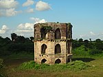 More images | ||
| N-MH-N16 | Jiwanpura Gate | Ellichpur (Achalpur) | Amaravati |  Upload Photo | ||
| N-MH-N17 | Temple of Anandeshwar | Lasur | Lasur, Tehsil Daryapur | Amaravati | 20°51′50″N 77°14′06″E / 20.8639871°N 77.2350816°E |  |
| N-MH-N18 | All the remains of the circumambulation wall of Pauni Fort | Pauni | Bhandara |  Upload Photo | ||
| N-MH-N19 | Ancient mounds situated to the south-east of the fort immediately beyond the moat outside on which a modern temple of Jagannath stands | Pauni | Bhandara |  Upload Photo | ||
| N-MH-N20 | Mound known as Hardulala-ki-Tekri | Pauni | Bhandara |  Upload Photo | ||
| N-MH-N21 | Cromlesh known as 'Tillota' (Frying Pan) | Pimpalgaon | Bhandara |  Upload Photo | ||
| N-MH-N22 | Moti Samadhi | Deulgaon Raja | Buldhana |  Upload Photo | ||
| N-MH-N23 | Three old Temples | Dhotra | Buldhana |  Upload Photo | ||
| N-MH-N24 | Mosque | Fathekheda (Sakharkheda) | Buldhana | 20°12′22″N 76°23′46″E / 20.2062°N 76.3962°E |  Upload Photo | |
| N-MH-N25 | Two old Temple | Kothali | Buldhana |  Upload Photo | ||
| N-MH-N26 | Dharmasala on the west of the town which is partially ruined and locally called Chhatra | Lonar | Buldhana |  Upload Photo | ||
| N-MH-N27 | Fifteen Temples on the way down to the lake and situated around it | Lonar | Buldhana |  Upload Photo | ||
| N-MH-N28 | Gaimukha Temple & Tank | Lonar | Buldhana | 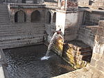 | ||
| N-MH-N29 | Gaimukha Temple No 1 of Daitya Sudana | Lonar | Buldhana |  Upload Photo | ||
| N-MH-N30 | Square Kunda on the East of the Town | Lonar | Buldhana |  Upload Photo | ||
| N-MH-N31 | Old temple of Daityasudana | Lonar | Buldhana | 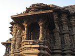 More images | ||
| N-MH-N32 | Old Dharmasala at North-West corner of the town | Mehkar | Buldhana |  Upload Photo | ||
| N-MH-N33 | Mosque | Rohinkhed | Buldhana | 20°37′47″N 76°07′46″E / 20.629764°N 76.129444°E |  | |
| N-MH-N34 | Old Temple of Mahadev | Sakegaon | Buldhana | 20°20′47″N 76°10′16″E / 20.346415°N 76.171069°E |  Upload Photo | |
| N-MH-N35 | Old Temple of Vishnu, remains of an old building to the east of that temple and remains of a small temple | Satgaon | Buldhana |  Upload Photo | ||
| N-MH-N36 | Lakhuji Jadhavrao's Samadhi | Sindhkhed Raja | Buldhana |  Upload Photo | ||
| N-MH-N37 | Tank | Sindhkhed Raja | Buldhana |  Upload Photo | ||
| N-MH-N38 | Temple of Mahadeva | Sindhkhed Raja | Buldhana |  Upload Photo | ||
| N-MH-N39 | Fort Wall | Ballarpur | Chandrapur |  Upload Photo | ||
| N-MH-N40 | Fort at Bhandak | Bhandak | Chandrapur |  Upload Photo | ||
| N-MH-N41 | A large high knoll immediately to the east of Bhadranath temple with remains of a temple, with huge stone carved blocks & a figure of Ganapati | Bhandak | Chandrapur |  Upload Photo | ||
| N-MH-N42 | Vijasan Caves - Pandavas caves containing three images | Bhandak | Vijasan, Bhadravati | Chandrapur | 20°05′50″N 79°05′53″E / 20.097222°N 79.098056°E |  |
| N-MH-N43 | Walled enclosure outside the Anchaleshver temple and another small temple within the enclosure | Chandrapur | Chandrapur | 19°56′46″N 79°18′11″E / 19.9460°N 79.3030°E |  Upload Photo | |
| N-MH-N44 | The enclosure & buildings of the Gond Raja's Tomb just outside the Anchaleshwar gate the city | Chandrapur | Chandrapur |  Upload Photo | ||
| N-MH-N45 | Fort Wall | Chandrapur | Chandrapur | 19°56′40″N 79°18′05″E / 19.9444°N 79.3014°E |  | |
| N-MH-N46 | Lalpeth monoliths consisting of the sixteen colosal stone images. i. Anna Purna, ii. Tortoise, iii. Fish, iv. Snake, v. Hanuman, vi. Hanuman, vii. Ganpati, viii. Ganpati, ix. Mahadeo, x. Kali, xi. Bhim, xii. Rawan, xiii. Nandi, xiv. Mahadeo, xv. Ganga, xvi. Ganga, xvi. Ganga | Chandrapur | Chandrapur |  Upload Photo | ||
| N-MH-N47 | Mahadeo Temple close to the Municipal office | Chandrapur | Chandrapur |  Upload Photo | ||
| N-MH-N48 | Temple of the Mahakali | Chandrapur | Chandrapur | 19°56′34″N 79°18′14″E / 19.9428°N 79.3040°E |  Upload Photo | |
| N-MH-N49 | A temple of Keshavanath built in the Hemadpanti style | Churul | Chandrapur |  Upload Photo | ||
| N-MH-N50 | Ancient Temple | Deotek | Chandrapur |  Upload Photo | ||
| N-MH-N51 | Hemadpanthi Temple containing images of Dattatraya, Mahadev & Laxminarayan | Dhanora | Chandrapur |  Upload Photo | ||
| N-MH-N52 | Old Bridge at Ghutakala | Ghutakala-Raiyatwari (Bhandak) | Chandrapur |  Upload Photo | ||
| N-MH-N53 | Old Temple of Chandikadevi | Ghutakala-Raiyatwari (Bhandak) | Chandrapur |  Upload Photo | ||
| N-MH-N54 | Remains of an old Fort | Khatora | Chandrapur |  Upload Photo | ||
| N-MH-N55 | Mahadeo’s Temple (Hemadpanti) | Mahadwari | Chandrapur |  Upload Photo | ||
| N-MH-N56 | Temple of Mahadeo | Neri | Chandrapur |  Upload Photo | ||
| N-MH-N57 | Ramdigi temple & Ramdigi pool | Nimdhela Forest | Chandrapur |  Upload Photo | ||
| N-MH-N58 | Old Hemadpanthi Temple | Palebaras | Chandrapur |  Upload Photo | ||
| N-MH-N59 | An Old Temple of Mahadeo of the style of Markanda Temple | Rajgarh | Chandrapur |  Upload Photo | ||
| N-MH-N60 | Temple | Armori | Gadchiroli |  Upload Photo | ||
| N-MH-N61 | Stone Circle | Arsoda | Gadchiroli |  Upload Photo | ||
| N-MH-N62 | A group of twenty cromlechs or Kistvaens | Chamurshi | Gadchiroli |  Upload Photo | ||
| N-MH-N63 | Rock Caves | Jharapara | Gadchiroli |  Upload Photo | ||
| N-MH-N64 | Group of Temples | Markanda | Gadchiroli | 19°59′40″N 79°51′59″E / 19.9944°N 79.8664°E |  | |
| N-MH-N65 | Fortress of Tipagarh situated on the summit of mountain region | Murumgaon Zamindari | Gadchiroli |  Upload Photo | ||
| N-MH-N66 | Two temples (one small and one large) which are closely situated | Thanegaon | Gadchiroli |  Upload Photo | ||
| N-MH-N67 | Fort wall | Wairagarh | Gadchiroli | 20°25′54″N 80°05′33″E / 20.4316°N 80.0926°E |  Upload Photo | |
| N-MH-N68 | Temple of Bhandareshwar | Wairagarh | Gadchiroli | 20°25′34″N 80°05′06″E / 20.4260°N 80.0851°E |  Upload Photo | |
| N-MH-N69 | Area containing the old remains of two temples consisting of a collection of massive stones in two separate heaps, One immediately outside Padampur to the north & the other immediately to the south of Ganeshpur | Padampur | Gondia |  Upload Photo | ||
| N-MH-N70 | Remains of the temple to the North of the Village | Padampur | Gondia |  Upload Photo | ||
| N-MH-N71 | Remains of the temple to the North-west of the village | Padampur | Gondia |  Upload Photo | ||
| N-MH-N72 | Remains of the temple close to the south of the village Ganeshpur | Padampur | Gondia |  Upload Photo | ||
| N-MH-N73 | Remains of the temple locally known as Nath Bawa | Padampur | Gondia |  Upload Photo | ||
| N-MH-N74 | Fort at Pratapgad | Pratapgarh | Gondia |  Upload Photo | ||
| N-MH-N75 | Fort on the bank of the river, said to have been built by Jatba, one of the Gond kings | Bhiwagarh | Nagpur | 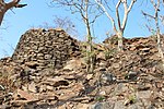 | ||
| N-MH-N76 | Fort at the bottom of the hill | Donagartal | Nagpur |  Upload Photo | ||
| N-MH-N77 | Temple | Ghogra | Nagpur |  Upload Photo | ||
| N-MH-N78 | Stone Circle | Ghorar | Nagpur |  Upload Photo | ||
| N-MH-N79 | Stone Circle | Junapani | Near Fetari, down MH SH 248. | Nagpur | 21°11′49″N 78°59′56″E / 21.196916°N 78.998911°E |  More images |
| N-MH-N80 | Ancient Buddhist remains comprising monastery, stupas, Rock-cut inscription etc. | Mansar & Kahari | Nagpur | 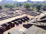 | ||
| N-MH-N81 | Old High Court Building | Nagpur | Nagpur |  Upload Photo | ||
| N-MH-N82 | Stone circle | Nildho | Nagpur |  Upload Photo | ||
| N-MH-N83 | Kalimata's Temple | Ramtek | Nagpur |  | ||
| N-MH-N84 | The remains of a very old shrines upon the western ridge at the end of the Ramtek hill overlooking the town between the group of temples and the bungalow. The shrine consists simply of a portion of porch of a temple and the mutilated image of the Trivikram Avatara of Vishnu | Ramtek | Nagpur |  | ||
| N-MH-N85 | The tank and Mandapa opposite to the Dattatraya's Temple | Ramtek | Nagpur |  | ||
| N-MH-N86 | Stone Circle | Takalghat | Nagpur |  Upload Photo | ||
| N-MH-N87 | Fort | Paunar | Wardha |  | ||
| N-MH-N88 | Hemadpanti Temple of Mahadeo known by name Someshwar | Neir | Yeotmal |  Upload Photo | ||
| N-MH-N89 | Temple of Goddess Pandhardevi | Pandhardevi | Yeotmal |  Upload Photo | ||
| N-MH-N90 | Temple of Kamaleshwar | Pathrot | Yeotmal |  Upload Photo | ||
| N-MH-N91 | Mahadeo’s Temple | Rant Swangi | Yeotmal |  Upload Photo | ||
| N-MH-N92 | Mahadeo’s Temple | Rui-Wai | Yeotmal |  Upload Photo | ||
| N-MH-N93 | Hemadpanthi Temple of Shree Mahadev (Taponeshwar) | Tapona | Yeotmal |  Upload Photo | ||
| N-MH-N94 | Mahadeo’s Temple | Yelabara | Yeotmal |  Upload Photo |
See also
[edit]References
[edit]- ^ "List of Centrally Protected Monuments / Sites under the jurisdiction of Maharashtra (Aurangabad Circle, Mumbai Circle and Nagpur Circle)" (PDF). Archaeological Survey of India. August 2021. Retrieved 27 November 2022.
