Leigh Reservoir
| Leigh Reservoir | |
|---|---|
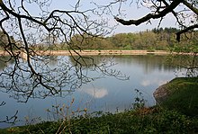
 The reservoir in April 2009 | |
| Country | England |
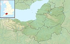
| Location | Pitminster, Somerset |
| Coordinates | 50°57′10″N 3°08′40″W / 50.952712°N 3.144439°W |
| Status | Full |
| Opening date | 1893 |
| Operator(s) | Wessex Water |
| Reservoir | |
| Catchment area | 20.5 hectares (51 acres) |
| Surface area | 2.128 hectares (5.26 acres) |
| Normal elevation | 160 metres (520 ft) |
Leigh Reservoir, or Leigh Hill Reservoir, is a small reservoir in Somerset, England. It was built in 1893 to supply water to the town of Taunton, Somerset, which lies to the north. Water quality is good.
Location
[edit]Leigh Reservoir is an artificial lake in the parish of Pitminster, Somerset, 15.1 kilometres (9.4 mi) from the sea.[1] It is to the west of Luxhay Reservoir and south of the village of Lowton, near to Angersleigh.[2] It is 160 metres (520 ft) above sea level.[3] The reservoir is near the southern boundary of the River Tone catchment basin.[4] In 1912 the reservoir had an 8 inches (200 mm) rain gauge 1.5 feet (0.46 m) above ground that recorded rainfall on 180 days of 43.34 inches (1,101 mm) in total.[5]
Description
[edit]A plaque on the reservoir is dated 1893, and gives the surface area of water as 6 acres (2.4 ha) and greatest depth 38 feet (12 m). It was to contain 26,000,000 imperial gallons (120,000,000 L; 31,000,000 US gal). The reservoir was built by Bond & Hitchcock, contractors.[6] It was operated by the Taunton Waterworks.[7] The reservoir today has an average depth of 1.33 metres (4 ft 4 in) and a surface area of 2.128 hectares (5.26 acres), with a catchment area of 20.5 hectares (51 acres).[3] The perimeter is 0.6 kilometres (0.37 mi).[1]
Leigh and Luxhay reservoirs are managed today by Wessex Water. In 2013 Wessex Water arranged for installation of physical and electronic security systems in both reservoirs, using a system of pontoons during installation. Leigh Reservoir is accessed via a single entry point on top. A secure access cover was installed, enclosed in a high security cage.[8]
Water quality
[edit]During the Routine Monitoring Programme of 1990 the reservoir was listed as containing "abundant" blue-green algae.[9] No bloom or scum were observed, although there was scum on Luxhay Reservoir.[10] Leigh Reservoir is one of three in the Tone catchment that are monitored under the EC Surface Water Abstraction Directive, the others being the Clatworthy Reservoir and Luxhay Reservoir. A 1998 report said that none of these reservoirs had exceeded the standard for dissolved and emulsified hydrocarbons since UV fluorescence tests began in September 1997.[11] As of 2015 water quality was good both chemically and ecologically.[3]
Notes
[edit]- ^ a b Leigh Reservoir – British Lakes.
- ^ Leigh Reservoir – Environment Agency, map.
- ^ a b c Leigh Reservoir – Environment Agency.
- ^ Turner 1998, p. 1.
- ^ Mill & Salter 1913, p. 264.
- ^ Chipchase 2009.
- ^ Wright 2015, p. 281.
- ^ Miles 2013.
- ^ NRA Report of the Blue-Green Algal Monitoring 1990, p. 30.
- ^ NRA Report of the Blue-Green Algal Monitoring 1990, p. 38.
- ^ Turner 1998, p. 5.
Sources
[edit]- Chipchase, Nick (20 April 2009), Leigh Hill Reservoir - plaque, retrieved 21 August 2016
- "Leigh Reservoir", British Lakes, retrieved 21 August 2016
- Leigh Reservoir, Environment Agency, retrieved 21 August 2016
- Miles, Michael (October 2013), Towering Feat of Security for Wessex Water, Technocover, retrieved 21 August 2016
- Mill, Hugh Robert; Salter, Carle (1913), "Division V. - South Western Counties", British Rainfall, 1912 (PDF), London: Edward Stanford, retrieved 21 August 2016
- NRA Report of the Blue-Green Algal Monitoring 1990 (PDF), National Rivers Authority, Anglian Region, June 1991, retrieved 21 August 2016
- Turner, Alan (1998), First Annual Review of the River Tone Catchment Management Plan (PDF), retrieved 21 August 2016
- Wright, Brian (25 November 2015), Andrew Crosse and the mite that shocked the world: The life and work of an electrical pioneer, Troubador Publishing Ltd, ISBN 978-1-78462-438-5, retrieved 21 August 2016
External links
[edit]![]() Media related to Leigh Reservoir at Wikimedia Commons
Media related to Leigh Reservoir at Wikimedia Commons

