Lawson, Colorado
Appearance
Lawson, Colorado | |
|---|---|
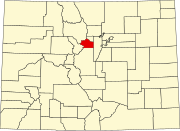
Location within the state of Colorado
Location in Clear Creek County and the State of Colorado | |
| Coordinates: 39°45′50″N 105°37′25″W / 39.76389°N 105.62361°W | |
| Country | |
| State | |
| County | Clear Creek County[1] |
| Elevation | 8,107 ft (2,471 m) |
| Time zone | UTC-7 (MST) |
| • Summer (DST) | UTC-6 (MDT) |
| ZIP code | Dumont CO 80436 |
| Area code(s) | Both 303 and 720 |
| GNIS feature ID | 0204705 |
Lawson is a small unincorporated community situated along Clear Creek in Clear Creek County, Colorado, United States. Lawson is a part of the Downieville-Lawson-Dumont census-designated place.
History
[edit]A post office called Lawson was established in 1877, and remained in operation until 1966.[2] The community was named for Alexander Lawson, the proprietor of a local inn.[3][4]
Geography
[edit]Lawson is located at 39°45′50″N 105°37′25″W / 39.76389°N 105.62361°W (39.76395,-105.623674).
See also
[edit]- Denver-Aurora Metropolitan Statistical Area
- Denver-Aurora-Boulder Combined Statistical Area
- Front Range Urban Corridor
- List of cities and towns in Colorado
References
[edit]- ^ a b "US Board on Geographic Names". United States Geological Survey. October 25, 2007. Retrieved January 31, 2008.
- ^ "Clear Creek County". Jim Forte Postal History. Retrieved June 14, 2015.
- ^ Gannett, Henry (1905). The Origin of Certain Place Names in the United States. U.S. Government Printing Office. p. 183.
- ^ Dawson, John Frank. Place names in Colorado: why 700 communities were so named, 150 of Spanish or Indian origin. Denver, CO: The J. Frank Dawson Publishing Co. p. 32.


