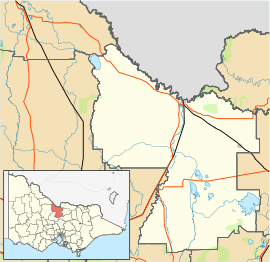
Lancaster, Victoria
| Lancaster Victoria | |
|---|---|
 Primary school | |
| Coordinates | 36°18′0″S 145°07′0″E / 36.30000°S 145.11667°E |
| Population | 393 (2016 census)[1] |
| Postcode(s) | 3620 |
| Location |
|
| LGA(s) | |
| State electorate(s) | Murray Plains |
| Federal division(s) | Nicholls |
Lancaster is a locality in the Goulburn Valley region of Victoria, Australia. The town is located in Shire of Campaspe and the City of Greater Shepparton. At the 2016 census, Lancaster had a population of 393.[1]
History
[edit]The locality was named after Thomas Lancaster, an early settler in the region and the father of the state parliamentarian, Samuel Lancaster.[2]
The Post Office opened on 15 November 1878 and a Kyabram East office opened on 28 November 1878. In 1881 the Lancaster office closed and Kyabram East was renamed Lancaster. This office closed in 1994.[3]
Today
[edit]The town has an Australian Rules football team competing in the Kyabram & District Football League.
The town also has a small primary school with about 40 children.
References
[edit]- ^ a b "2016 Census QuickStats Lancaster". Australian Bureau of Statistics. Retrieved 16 February 2019.
- ^ Rollison, Kay. "Lancaster, Samuel (1852 - 1918)". Australian Dictionary of Biography. Australian National University. Retrieved 9 May 2007.
- ^ Phoenix Auctions History. "Post Office List". Retrieved 11 March 2021.
External links
[edit]![]() Media related to Lancaster, Victoria at Wikimedia Commons
Media related to Lancaster, Victoria at Wikimedia Commons


