Laleia River
| Laleia River | |
|---|---|
 A braided channel of the river, lined with Savanna and Casuarina | |
| Native name |
|
| Location | |
| Country | East Timor |
| Municipalities | |
| Physical characteristics | |
| Source confluence | |
| • location | Manatuto / Viqueque border |
| Mouth | Wetar Strait |
• location | Suco Lifau (Laleia) |
• coordinates | 8°29′47″S 126°09′39″E / 8.496322°S 126.160759°E |
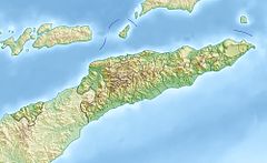
The Laleia River (Portuguese: Ribeira de Laleia or Rio de Laleia, Tetum: Mota Laleia) is a major river in northeastern East Timor.
The river flows primarily in a northerly direction from headwaters in Timor's central mountains; after running through the eponymous Laleia Administrative Post, it discharges into Wetar Strait.[1]
Catchment
[edit]The river's catchment or drainage basin is approximately 533 km2 (206 sq mi) in area.[2]: 9 East Timor has been broadly divided into twelve 'hydrologic units', groupings of climatologically and physiographically similar and adjacent river catchments.[2]: 2, 52 [3] The Laleia River catchment is one of the two major catchments in the Laleia hydrologic unit, which is about 1,009.9 km2 (389.9 sq mi) in total area; the other is the Vemasse River catchment.[2]: 9, 52, 58
See also
[edit]References
[edit]- ^ República Democrática de Timor-Leste: Manatuto [Democratic Republic of Timor-Leste: Manatuto] (PDF) (Map). 1:75000 (in Portuguese). Cartography by Instituto Superior Técnico. Lisbon: Timor-Leste GIS Portal. Archived from the original (PDF) on 20 March 2012. Retrieved 26 May 2024.
- ^ a b c Costin, Graham; Powell, Bronwyn (2006). Situation Analysis Report: Timor-Leste (PDF) (Report). Brisbane: International WaterCentre. Retrieved 26 May 2024.
- ^ AQUASTAT Country Profile – Timor-Leste (PDF) (Report). Rome: Food and Agriculture Organization of the United Nations (FAO). 2011. p. 4. Retrieved 25 June 2022.
External links
[edit]![]() Media related to Laleia River at Wikimedia Commons
Media related to Laleia River at Wikimedia Commons

