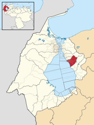
Lagunillas Municipality, Zulia
Appearance
Lagunillas Municipality
Municipio Lagunillas | |
|---|---|
 Location in Zulia | |
| Coordinates: 10°12′10″N 71°10′22″W / 10.2028°N 71.1728°W | |
| Country | |
| State | Zulia |
| Municipal seat | Ciudad Ojeda |
| Area | |
• Total | 1,768.4 km2 (682.8 sq mi) |
| Time zone | UTC−4 (VET) |
Lagunillas Municipality is one of the 21 municipalities that make up Zulia State, Venezuela. There are about 170,000 inhabitants. The shire town is Ciudad Ojeda. It is also the lowest municipality in Venezuela, by -12 m.


