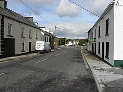
Laghy
Laghy
An Lathaigh | |
|---|---|
Village | |
 Main Street | |
| Coordinates: 54°37′00″N 8°05′15″W / 54.616667°N 8.087461°W | |
| Country | Ireland |
| Province | Ulster |
| County | County Donegal |
| Government | |
| • Dáil constituency | Donegal |
| Population | |
| • Total | 183 |
| Area code | +353 74 |
| Irish Grid Reference | G939748 |
Laghy[2] or Laghey (LAH-hee; Irish: An Lathaigh)[2] is a village and townland in County Donegal, Ireland, between Ballintra and Donegal Town. It is one of three villages that make up the parish of Drumholm, formerly a civil and Church of Ireland parish, now only used as a division of the Roman Catholic Diocese of Raphoe. The village has a quarry, a supermarket, garden centre, filling station, two public houses, a church with a graveyard, an Orange hall, a recycling centre, a Donegal County Council yard and salt depot, and a national school (St Eunan's NS). Rossnowlagh and Murvagh beaches are nearby. Murvagh is also the home to Donegal Golf Club.
Landmarks
[edit]
Landmarks in the village include the Seven Arches Bridge at the bottom of the main street, and a signpost within the village that says Laghey is 1 km away.[citation needed]
Transport
[edit]Rail transport
[edit]Laghey railway station opened on 1 September 1905, was shut for goods traffic on 15 December 1947 and shut altogether on 1 January 1960.[3] The station was part of the County Donegal Railways Joint Committee network.
Bus transport
[edit]Laghey is served by Bus Éireann route 480.[4]
Education
[edit]St Eunan's National School (Irish: Scoil Náisiúnta Naomh Adhamhnáin) is the only school remaining in the village. It is a Catholic primary school, one of two in the parish of Drumholm, under the patronage of the Bishop of Raphoe, and is named after Saint Eunan, one of the two patron saints of the diocese. The school was built in the first half of the twentieth century and is in the design of many others built across the country at this time.
The original school had two class rooms, while an extension, which opened in 1992, added a further two to the west end of the existing building. The school is directly adjacent to the main N15 Sligo to Letterkenny road, which also cuts the school off from the main part of the village. Because of this, when the village was being by-passed for the upgrading of the route, a tunnel had to be constructed to allow those living to the east of the road in the main part of the village to access the school safely.[5]
Secondary education is provided by the Abbey Vocational School in Donegal Town, while a small number attend Colaiste Cholmcille in Ballyshannon.

Sport
[edit]The local Gaelic Athletic Association club is called Naomh Bríd (the club also includes Ballintra). The local soccer club is called Copany Rovers F.C. (also including Ballintra).[citation needed]
See also
[edit]References
[edit]- ^ "Census 2016 Sapmap Area: Settlements Laghy". Central Statistics Office (Ireland). Retrieved 4 June 2018.
- ^ a b Laghy/An Lathaigh. Placenames Database of Ireland.
- ^ "Laghy station" (PDF). Railscot - Irish Railways. Retrieved 28 October 2007.
- ^ "Regional Services by County". Bus Éireann. Retrieved 31 May 2021.
- ^ Trimble, Rev. Canon T.H.. The Legacy that is Laghey Community and Church


