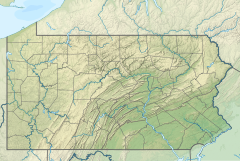
Lafferty Run (Kendall Creek tributary)
Appearance
| Lafferty Run Tributary to Kendall Creek | |
|---|---|
| Location | |
| Country | United States |
| State | Pennsylvania |
| County | McKean |
| Physical characteristics | |
| Source | Foster Brook divide |
| • location | about 1 mile southwest of Red Rock, Pennsylvania |
| • coordinates | 41°57′28.00″N 078°33′41.00″W / 41.9577778°N 78.5613889°W[1] |
| • elevation | 2,020 ft (620 m)[1] |
| Mouth | Kendall Creek |
• location | about 2 miles east of Bradford, Pennsylvania |
• coordinates | 41°57′23.23″N 078°36′21.09″W / 41.9564528°N 78.6058583°W[1] |
• elevation | 1,467 ft (447 m)[1] |
| Length | 2.19 mi (3.52 km)[2] |
| Basin size | 1.49 square miles (3.9 km2)[3] |
| Discharge | |
| • location | Kendall Creek |
| • average | 2.93 cu ft/s (0.083 m3/s) at mouth with Kendall Creek[3] |
| Basin features | |
| Progression | Kendall Creek → Tunungwant Creek → Allegheny River → Ohio River → Mississippi River → Gulf of Mexico |
| River system | Allegheny River |
| Tributaries | |
| • left | unnamed tributaries |
| • right | unnamed tributaries |
| Bridges | Red Rock Ridge Road, Lafferty Hollow (x3) |
Lafferty Run is a 2.19 mi (3.52 km) long first-order tributary to Kendall Creek.[2]
Course
[edit]Lafferty Run rises about 1 mile (1.6 km) southwest of Red Rock, Pennsylvania and then flows west-northwest to meet Kendall Creek about 2 miles (3.2 km) east of Bradford, Pennsylvania.
Watershed
[edit]Lafferty Run drains 1.49 square miles (3.9 km2) of area, receives about 44.2 in/year (112 cm/year) of precipitation, and is about 94.30% forested.[3]
See also
[edit]References
[edit]- ^ a b c d "Geographic Names Information System". edits.nationalmap.gov. US Geological Survey. Retrieved January 18, 2023.
- ^ a b "ArcGIS Web Application". epa.maps.arcgis.com. US EPA. Retrieved January 18, 2023.
- ^ a b c "Watershed Report | Office of Water | US EPA". watersgeo.epa.gov. US EPA. Retrieved January 18, 2023.


