Löddeköpinge
Löddeköpinge | |
|---|---|
 | |
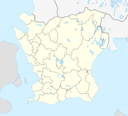
| Coordinates: 55°46′N 13°01′E / 55.767°N 13.017°E | |
| Country | Sweden |
| Province | Scania |
| County | Scania County |
| Municipality | Kävlinge Municipality |
| Area | |
| • Total | 3.62 km2 (1.40 sq mi) |
| Population (31 December 2010)[1] | |
| • Total | 6,290 |
| • Density | 1,740/km2 (4,500/sq mi) |
| Time zone | UTC+1 (CET) |
| • Summer (DST) | UTC+2 (CEST) |
Löddeköpinge is the second-largest locality in Kävlinge Municipality, Scania County, Sweden, with 6,290 inhabitants as of 2010.[1]
Löddeköpinge is about 10 km southwest of the municipal seat Kävlinge and about 5 km from Barsebäck nuclear power plant.
The locality lies in the former parish of Löddeköpinge, which was an annex (subordinate) parish to that of Borgeby, located in the härad of Harjager and in the deanery of Torna and Diocese of Lund. In 1911 it covered 1884 hectares and had 1131 inhabitants.[2] As a division of the Church of Sweden, Löddeköpinge parish became Borgeby's mother parish in 1937 and was transferred to the deanery of Harjager in 1939. Since 1962, it has been merged with Borgeby, Barsebäck, Hofterup and Hög as a single parish in the deanery of Rönneberga.[3]
References
[edit]- ^ a b c "Tätorternas landareal, folkmängd och invånare per km2 2005 och 2010" (in Swedish). Statistics Sweden. 14 December 2011. Archived from the original on 27 January 2012. Retrieved 10 January 2012.
- ^ "Löddeköpinge", Nordisk familjebok, 17:240
- ^ Archive catalogue of SVAR, Swedish Archive Information, National Archives of Sweden, [1]


