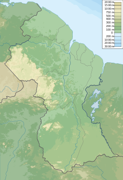
Kurupung River
| Kurupung River | |
|---|---|
| Location | |
| Country | Guyana |
| Physical characteristics | |
| Mouth | Mazaruni River |
The Kurupung River is a tributary of the middle Mazaruni River[1] in Guyana.
Kumerau Falls[2] is a feature of the river.
Mineral resources
[edit]The area around the river has been used for diamond mining.[3][4] It was the location for Guyana's first diamond rush of the 1920s.[5] The largest stone recorded as found weighed 29 and five-sixteenth carats[6] and was brought to the commissioner of lands and mines in 1921. It was called 'Kurupung' and bought for USD $4000.[7]
U3O8 Corp of Canada prospected for uranium in the Kurupung batholith around 2010.[8]
Settlement
[edit]Kurupung is a mining village along the river.
Since the 1970s, the Kurupung River has been of interest for a possible hydroelectric dam. The project was criticized by the Akawaio, because it would flood out their communities.[9] In 2013, Sandspring Resources signed a Memorandum of Understanding with the government of Guyana giving the company the exclusive right to develop the Kurupung River Hydroelectric Project, estimated to produce 100 megawatts of electricity, half of which to support their mining project at Toroparu.[10][11]
See also
[edit]References
[edit]- ^ Andrade, Marcelo C.; López-Fernández, Hernán; Liverpool, Elford A. (2019-11-25), Fig. 5. Collection localities for Myloplus taphorni. a in New Myloplus from Essequibo River basin, Guyana, with discussion on the taxonomic status of Myleus pacu (Characiformes: Serrasalmidae), retrieved 2021-01-21
- ^ "RU Alumnus recounts a job where it really is a jungle out there". www.radford.edu. Retrieved 2021-01-21.
- ^ "Kumaka Landing Right Bank Of Kurupung Diamond Mine In Pomeroon-Supenaam, Guyana". The Diggings™. Retrieved 2021-01-21.
- ^ Mines, British Guiana Department of Lands and (1926). Annual Report of the Lands and Mines Department. The Department. p. 9.
- ^ Richards, Jim (2016-09-01). Gold Rush. Fremantle Press. ISBN 978-1-925164-02-2.
- ^ Rothwell, Richard Pennefather; Struthers, Joseph; Newland, David Hale; Judd, Edward K.; Ingalls, Walter Renton (1922). The Mineral Industry, Its Statistics, Technology, and Trade ... Scientific Publishing Company. p. 596.
- ^ Adventure. Ridgway Company. 1924. p. 187.
- ^ Bureau, Mines; Survey, Geological; Department, Interior (2013-12-02). Minerals Yearbook - Area Reports: International Review: 2011, Latin America and Canada. Government Printing Office. ISBN 978-1-4113-3670-4.
{{cite book}}:|last1=has generic name (help) - ^ "Survival International: Report exposes threat to dam 'Lost World'". forestpeoples.org. Survival International.
- ^ "Canadian mining company commits to building 100MW Kurupung hydro project". Kaieteur News. 2015-11-12. Retrieved 2021-01-21.
- ^ "Gran Colombia Gold to Acquire Approximately 15% Interest in Sandspring Resources Ltd". Bloomberg.com. 2018-06-12. Retrieved 2021-01-21.
Bibliography
[edit]- Rand McNally, The New International Atlas, 1993.

