Kumari, Nepal
Appearance
Kumari
कुमरी | |
|---|---|
| Coordinates: 27°47′N 85°08′E / 27.79°N 85.14°E | |
| Country | Nepal |
| Zone | Bagmati Zone |
| District | Nuwakot District |
| Population (1991) | |
• Total | 6,458 |
| Time zone | UTC+5:45 (Nepal Time) |
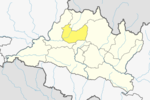
Kumari is a village development committee in Nuwakot District in the Bagmati Zone of central Nepal. At the time of the 1991 Nepal census it had a population of 6458 people living in 1132 individual households.[1]
Clinic
[edit]


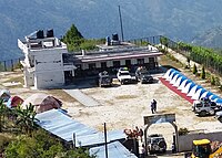
The Sukman Medical Polyclinic was built by the Health and Ed 4 Nepal[2] non-profit, which provides ongoing support. The clinic was severely damaged by the 23 April 2015 earthquake that struck Nepal but remains in partial operation.
Schools
[edit]
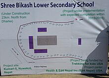
The local pre-secondary school, Shree Bikash, was also severely damaged in the 23 April 2015 earthquake and its remains were demolished. Re-building of the school began in November 2015 via funding sourced by the non-profits Trekking for Kids[3] and Health and Ed 4 Nepal.
References
[edit]- ^ "Nepal Census 2001", Nepal's Village Development Committees, Digital Himalaya, archived from the original on 12 October 2008, retrieved 6 October 2008
- ^ Health and Ed 4 Nepal
- ^ Trekking for Kids
External links
[edit]


