Krosno Airport
Appearance
Krosno Airport Port Lotniczy Krosno | |||||||||||
|---|---|---|---|---|---|---|---|---|---|---|---|
 | |||||||||||
| Summary | |||||||||||
| Airport type | Public | ||||||||||
| Serves | Krosno, Poland | ||||||||||
| Coordinates | 49°41′00″N 21°44′01″E / 49.68333°N 21.73361°E | ||||||||||
| Website | http://lotniskokrosno.com/ | ||||||||||
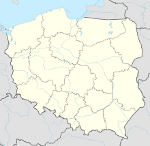
| Map | |||||||||||
 | |||||||||||
| Runways | |||||||||||
| |||||||||||
| Statistics (2007 +/- change from 2006) | |||||||||||
| |||||||||||
Wikimedia Commons has media related to Krosno Airport.
Krosno possesses an airport with disused concrete runway that could serve as a City-Airport[citation needed]. Town authorities are planning to start the modernisation by 2012[needs update].
As of July 2019, there are indications of recreational use.[2]
History
[edit]The airport was opened before the second World War, in 1932.
References
[edit]- ^ EAD Basic
- ^ Ranter, Harro. "Incident PZL-Bielsko SZD-30 Pirat SP-2573, 13 Jul 2019". aviation-safety.net. Retrieved 2020-03-15.
External links
[edit]Official website Krosnoairport.pl - for sale

