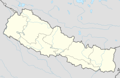
Kotihome
Appearance
| Kotihom/Kankai Dham | |
|---|---|
 Kotihom/Kankai Dham | |
| Religion | |
| Affiliation | Hinduism |
| District | Jhapa |
| Deity | Mahadev |
| Festivals | Sivaratri, Balachaturdasi, Teej, Rama Navami, Janai Purnima, Buddha jayanti |
| Location | |
| Location | Surunga, Jhapa District |
| State | Mechi zone |
| Country | Nepal |
| Geographic coordinates | 26°39′18″N 87°52′42″E / 26.65500°N 87.87833°E |

Kotihom Dham is a religious site in Eastern Development Region, Nepal. It is located in the Kankai Municipality of Jhapa District. Other names it famously goes by are Kankai Mai and Kankai Dham.
History
[edit]Since a long time ago people have come to worship in the Kankai River. They believe that doing so will fulfill their wishes. In the same way, in Poush of 2042 B.S. a great worship was done whole month in the leadership of yogi Narharinath. After that, this place developed into one of the religious sites of Nepal.[1]
References
[edit]- ^ "Kankai mai". Tourism Office Kakarvitta.
Wikimedia Commons has media related to Kotihome.

