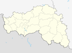
Kochegury
Appearance
Kochegury
Кочегуры | |
|---|---|
Selo | |
| Coordinates: 51°00′N 37°34′E / 51.000°N 37.567°E[1] | |
| Country | Russia |
| Region | Belgorod Oblast |
| District | Chernyansky District |
| Time zone | UTC+3:00 |
Kochegury (Russian: Кочегуры) is a rural locality (a selo) and the administrative center of Kochegurenskoye Rural Settlement, Chernyansky District, Belgorod Oblast, Russia. The population was 908 as of 2010.[2] There are 6 streets.
Geography
[edit]Kochegury is located 25 km northwest of Chernyanka (the district's administrative centre) by road. Protochnoye is the nearest rural locality.[3]
References
[edit]- ^ Карта Чернянского района Белгородской области
- ^ "Всероссийская перепись населения 2010 года. Белгородская область. 15. Численность неселения городских и сельских населённых пунктов" (PDF). Archived from the original (PDF) on 2018-11-23. Retrieved 2019-09-18.
- ^ Расстояние от Кочегур до Чернянки


