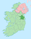
Knightsbrook
Appearance
Knightsbrook | |
|---|---|
Village | |
| Coordinates: 53°31′55″N 6°47′13″W / 53.531852°N 6.786913°W | |
| Country | Ireland |
| Province | Leinster |
| County | County Meath |
| Time zone | UTC+0 (WET) |
| • Summer (DST) | UTC-1 (IST (WEST)) |
Knightsbrook is a village and townland in County Meath, Ireland. It is located on the R158 road, close to the junction with the R159. to the south of Trim.[1][2]
The town is located in the civil parish of Laracor. Knightsbrook Hotel and Golf Club stands to the north, and the Knightsbrook River flows through the south of the townland.[3]
See also
[edit]References
[edit]- ^ "Knightsbrook Townland, Co. Meath". www.townlands.ie. Retrieved 8 July 2020.
- ^ "Knightsbrook". Logainm.ie. Retrieved 8 July 2020.
- ^ "Relation: Knightsbrook (4551683)". OpenStreetMap. Retrieved 8 July 2020.


