Kırkağaç
Kırkağaç | |
|---|---|
District and municipality | |
 | |
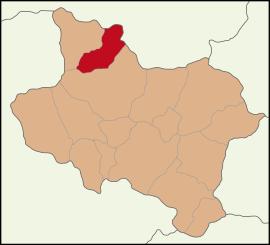
 Map showing Kırkağaç District in Manisa Province | |
| Coordinates: 39°06′20″N 27°40′24″E / 39.10556°N 27.67333°E | |
| Country | Turkey |
| Province | Manisa |
Area | 541 km2 (209 sq mi) |
| Elevation | 188 m (617 ft) |
| Population (2022)[1] | 37,645 |
| • Density | 70/km2 (180/sq mi) |
| Time zone | UTC+3 (TRT) |
| Postal code | 45700 |
| Area code | 0236 |
| Website | www |
Kırkağaç (Turkish: [ˈkɯɾkaːtʃ]) is a municipality and district of Manisa Province, Turkey.[2] Its area is 541 km2,[3] and its population is 37,645 (2022).[1] The town lies at an elevation of 188 m (617 ft).
Features
[edit]Kırkağaç is an agricultural district and known for its variety of melon known as Kırkağaç melon (Turkish: Kırkağaç kavunu).
Olive, walnut, tobacco and almond cultivation is among the important agricultural activities of Kırkağaç.[4]
There has been a road reconstruction in late 2021. A gas supply came to the city at the same time as to the city of Soma. A clock tower is situated in the center of the city.
History
[edit]From 1867 until 1922, Kırkağaç was part of the Aidin Vilayet of the Ottoman Empire. The Greek writer Elias Venezis, in his book Number 31328, states that Kırkağaç was burned from the Armenian quarter by the "enemy" who left;[5] although this book is a memoir, in later versions, the word "enemy" was changed to "Greek".[6]
Composition
[edit]There are 47 neighbourhoods in Kırkağaç District:[7]
- Alacalar
- Alifakı
- Bademli
- Bakır
- Boduroğlu
- Bostancı
- Çaltıcak
- Çiftlikköy
- Cinosman
- Çobanlar
- Demirtaş
- Dualar
- Fırdanlar
- Gebeler
- Gelembe
- Gökçukur
- Güvendik
- Hacet
- Hacıhimmet
- Halkaavlu
- Hamidiye
- Hamitli
- Hıdırağa
- İlyaslar
- Işıklar
- Kadriye
- Karaali
- Karakurt
- Kayadibi
- Kınık
- Kocaiskan
- Kocamehmetağa
- Küçükyaya
- Kuyucak
- Memiş
- Musahoca
- Musalar
- Öveçli
- Şaireşref
- Sakarlı
- Sarıağa
- Siledik
- Söğütalanı
- Tevfikiye
- Yağmurlu
- Yenimahalle
- Zorağa
References
[edit]- ^ a b "Address-based population registration system (ADNKS) results dated 31 December 2022, Favorite Reports" (XLS). TÜİK. Retrieved 12 July 2023.
- ^ Büyükşehir İlçe Belediyesi, Turkey Civil Administration Departments Inventory. Retrieved 12 July 2023.
- ^ "İl ve İlçe Yüz ölçümleri". General Directorate of Mapping. Retrieved 12 July 2023.
- ^ Gazete, Banka (21 November 2021). "Manisalı üreticilere fidan desteği devam ediyor". Gazete Banka. p. https://gazetebanka.com/. Retrieved 21 November 2021.
- ^ Venezis, Elias (1931). Το Νούμερο 31328: Σκλάβοι στα Εργατικά Τάγματα της Ανατολής: Ρομάντσο (in Greek). Mytilini, Greece. p. 103.
{{cite book}}: CS1 maint: location missing publisher (link) - ^ Venezis, Elias (2008). Το νούμερο 31328: Το βιβλίο της σκλαβιάς (in Greek). Hestia Publishers. p. 145. ISBN 9789600510119.
ΤΟ ΙΔΙΟ ΠΡΩΙ, άμα φύγαν οι μουσαφιραίοι, εμάς μας χώρισαν σε συντεχνίες. Μεγαλύτερη ανάγκη είχαν από χτίστες. Γιατί ο τόπος, εκεί κατά τ' Αρμένικα, ήταν καμένος απ' τον Έλληνα που είχε φύγει.
- ^ Mahalle, Turkey Civil Administration Departments Inventory. Retrieved 19 September 2023.
External links
[edit]


