Khwahan District
Khwāhān
خواهان | |
|---|---|
 | |
 | |
| Coordinates: 37°53′19″N 70°13′10″E / 37.88861°N 70.21944°E | |
| Country | |
| Province | Badakhshan |
| Region | Darwaz |
| Capital | Khwahan |
| Government | |
| • governor | Mohammad Ofran |
| Area | |
• Total | 30 sq mi (80 km2) |
| Elevation | 14,100 ft (4,300 m) |
| Population (2012) | |
• Total | 27,000[1] |
| • Ethnicities | |
| • Languages | Persian-Dari |
| Time zone | +4,30 |
| ISO 3166 code | AF,BDS,KWH |
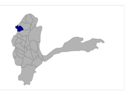
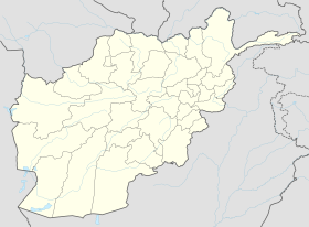
Khwahan District (Persian: شهرستان خواهان) (Pashto: خواهان ولسوالی) is one of the 28 districts of Badakhshan province, located in northeastern Afghanistan. The district capital is Khwahan. The district borders Raghistan to the southwest, Kuf Ab in the northeast, the Panj River in the northwest, and Shuro-obod district, Khatlon province of Tajikistan. Kuh-e kallat
Geography
[edit]

 Afghanistan and
  Tajikistan In Khwahan, region's and Shuro-obod
History
[edit]After Alexander the Great overthrew the Persians, the area came under the rule of [2] the Greco-Bactrian king Euthydemus I and his son Demetrius I[3]
Demography
[edit]The population of the district is approximately 27,000.[1] The inhabitants of this area are ethnic Tajiks who speak Dari Persian and are Sunni Muslim.
Subdivisions
[edit]List of villages and places, of Khwahan District in alphabetical order
- Ambaran
- Bagh-e Sangak
- Bid Khvah(1)
- Bed-e Khvah(2)
- Bariki
- Bostanak
- Chashma-i Tut
- Chosnukel
- Chetgah
- Darbandak
- Do Dargeh
- Drel
- Dowlatabad
- Ghalil
- Ghuzan
- Guzun
- Howz-e Shah-e Bala
- Howz-e Shah-e Pa'in
- Jerwu Bala
- Jerwu Pa'in
- Joy-i Saluk
- Kaji
- Kamar
- Kham-e Bahar
- Kham-e Tugh
- Khengan
- Kheyrabad
- Kowl Darrah
- Lal Margh
- Lughman
- Mushuk March
- Namaz-e Pas
- Now Abad
- Pari Kham
- Pashahr Abad
- Ruyanzar
- Safedab
- Safed Sangan
- Sang Ab
- Sar-e Biland
- Sayed Abad
- Sel Don
- Shahr-i Now
- Shalil
- Shing Darrah
- Tejkel
- Zardu
- Zarich
Economy
[edit]The inhabitants of this area engage in agriculture. They grow Buckwheat, red and white barley, sesame, zucchini, corn, mung beans, peas, beans, potatoes.
See also
[edit]References
[edit]External links
[edit]- Map at the Afghanistan Information Management Services[permanent dead link]
- Its coordinates are 37°53'19" N and 70°13'10" E in DMS (Degrees Minutes Seconds) or 37.8886 and 70.2194 (in decimal degrees). Its UTM position is XG09 and its Joint Operation Graphics reference is NJ42-11khwahan
- [1]


