Khamkhi
Khamkhi
Хамхи | |
|---|---|
| Other transcription(s) | |
| • Ingush | Хамхе |
 | |
| Coordinates: 42°49′20″N 44°55′35″E / 42.82222°N 44.92639°E | |
| Country | Russia |
| Federal subject | Ingushetia |
| Elevation | 1,230 m (4,040 ft) |
| Population | |
• Total | 0 |
| • Subordinated to | Dzheyrakhsky District |
| Time zone | UTC+3 (MSK |
| Postal code(s)[3] | 386430 |
| OKTMO ID | 26620450161 |
Khamkhi (Ingush: Хамхе, romanized: Khamkhe)[5] is an ancient city-settlement in Dzheyrakhsky District of Ingushetia.[6][7] It is part of the rural settlement of Guli (administrative center rural settlement).[8]
On the territory of the city-settlement there is an architectural complex "Khamkhi", represented by many historical objects: megalithic cyclopean tower-type dwellings, 4 combat towers, 4 semi-combat and 16 residential towers, as well as 10 crypt burial grounds. Currently, these objects of Ingush architecture and the entire territory of the settlement are included in the Dzheyrakh-Assa Museum-Reserve and are under state protection.
Geography
[edit]


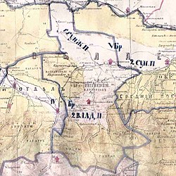
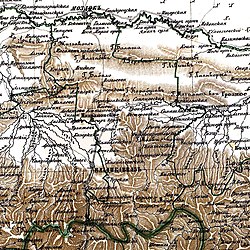
Khamkhi is located in Mountainous Ingushetia, on the left bank of the Assa river, on the territory of the historical region "Khyakhale" (from the Ingush "three-town"), being one of its three largest ancient cities-settlements.
History
[edit]On the territory of Khamkhi, the remains of megalithic cyclopean dwellings dating back to the 2nd-1st millennium BC were recorded.[9] It is here that scientists localized the ancient ethnonym Khamekits, mentioned by the ancient historian and geographer Strabo (transcribing the words "Khamekits" and "Khamkheti" as the "Country of Khamkhs").[10][11][12]
In the late Middle Ages, Khamkhi was territorially part of the Khamkhin society as its center. The settlement is ancestral home for the following Ingush teips: Khamkhoevs, Izmailovs, Bekbuzarovs, Martazanovs, Katsievs, Adzhievs, Matsievs, Umarovs, Bersanovs, Fatkhilgovs, Kadievs.
In the second half of the 18th century (1770s), the German researcher J.A. Güldenstädt indicated Targim among the total number of Ingush villages and districts.[13] Khamkhi was mentioned as an Ingush village in 1823 by S. M. Bronevskiy.[14]
References
[edit]- ^ Russian Federal State Statistics Service (2011). Всероссийская перепись населения 2010 года. Том 1 [2010 All-Russian Population Census, vol. 1]. Всероссийская перепись населения 2010 года [2010 All-Russia Population Census] (in Russian). Federal State Statistics Service.
- ^ "Об исчислении времени". Официальный интернет-портал правовой информации (in Russian). 3 June 2011. Retrieved 19 January 2019.
- ^ Почта России. Информационно-вычислительный центр ОАСУ РПО. (Russian Post). Поиск объектов почтовой связи (Postal Objects Search) (in Russian)
- ^ Итоги Всероссийской переписи населения 2020 года. Федеральная служба государственной статистики.
- ^ Мальсагов 1963, p. 149.
- ^ Чахкиев 2003, pp. 132–133.
- ^ Гадиев, Умалат. "Край башен и легенд — Горная Ингушетия". Archived from the original on 2016-11-08. Retrieved 2023-04-21. // «Discours»
- ^ "Закон Республики Ингушетия от 23 февраля 2009 года № 5-РЗ «Об установлении границ муниципальных образований Республики Ингушетия и наделении их статусом сельского поселения, муниципального района и городского округа»".
- ^ Чахкиев 2003, p. 103.
- ^ Виноградов & Чокаев 1966, p. 67.
- ^ Очерки истории Чечено-Ингушской АССР 1967, p. 25.
- ^ Крупнов 1971, p. 28.
- ^ Гюльденштедт 2002, p. 241.
- ^ Броневский 1823, p. 166.
Bibliography
[edit]- Мальсагов, З. К. (1963). Оздоева, Ф. (ed.). Грамматика ингушского языка [Grammar of the Ingush language] (in Ingush and Russian). Vol. 5 (2nd ed.). Грозный: Чечено-Ингушское Книжное Издательство. pp. 1–164.
- Виноградов, В. Б.; Чокаев, К. З. (1966). Виноградов, В. Б. (ed.). Древние свидетельства о названиях и размещении нахских племён [Ancient evidence of the names and location of the Nakh tribes]. Археолого-этнографический сборник (in Russian). Vol. 7 (1st ed.). Грозный: Чечено-Ингушское книжное издательство. pp. 1–179.
- Смирнов, Н. С., ed. (1967). Очерки истории Чечено-Ингушской АССР [Essays on the history of the Checheno-Ingush ASSR] (in Russian). Vol. 1. Грозный: Чечено-Ингушское книжное издательство. pp. 1–316.
- Крупнов, Е. И. (1971). Средневековая Ингушетия [Medieval Ingushetia] (in Russian). Москва: Наука. pp. 1–211.
- Гюльденштедт, Иоганн Антон (2002). "VI. Провинция Кистия, или Кистетия" [VI. Province of Kistia, or Kistetia]. In Карпов, Ю. Ю. (ed.). Путешествие по Кавказу в 1770-1773 гг. [Journey through the Caucasus in 1770-1773.] (in Russian). Translated by Шафроновской, Т. К. Санкт-Петербург: Петербургское Востоковедение. pp. 238–243. ISBN 5-85803-213-3.
- Броневский, С. М. (1823). "Кисты (глава третья)" [Kists (chapter three)]. Новейшие географические и исторические известия о Кавказе (часть вторая) [The latest geographical and historical news about the Caucasus (part two)] (PDF) (in Russian). Москва: Типография С. Селивановского. pp. 151–186.
- Чахкиев, Д. Ю. (2003). Древности Горной Ингушетии [Antiquities of Mountainous Ingushetia] (in Russian). Vol. 1.


