Kelly's Cave
| Kelly's Cave | |
|---|---|
| Uaimh Uí Cheallaigh | |
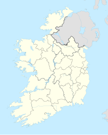
| Location | Nymphsfield, Cong, County Mayo |
| OSI/OSNI grid | M 152 557 |
| Coordinates | 53°32′40″N 9°16′45″W / 53.544443°N 9.279192°W |
| Length | 16 m (52 ft) |
| Discovery | prehistoric |
| Geology | Carboniferous Limestone |
| Entrances | 1 |
Kelly's Cave is a limestone solutional cave and National Monument in County Mayo, Ireland.
Location
[edit]Kelly's Cave lies in woodland 500 m (1,600 ft) northeast of Cong.
History
[edit]English antiquarian Wilfrid James Hemp suggested the cave may have had prehistoric use, comparing it to ancient caves in Sardinia.[1]
It has been suggested that the cave may have been extended and modified in the middle ages for use as a hermitage related to Cong Abbey.[2]
This cave is supposed to have taken its name from a fugitive named Kelly who took refuge there following the 1798 Rebellion.[citation needed]
Another local tradition claims that Kelly was a man who, along with his family, was forced to live there during the Penal era (17th–18th century). Kelly became a highwayman to survive.[citation needed]
Description
[edit]The cave is about 16 m (52 ft) long and consists of two rectangular chambers and a hole in the roof which acts as a skylight. Four steps lead down to an underground stream, and benches have been carved into the walls.[3][4]
References
[edit]- ^ "Geology" (PDF). Mayolibrary.ie. Retrieved 29 July 2018.
- ^ Dowd, Marion (31 January 2015). The Archaeology of Caves in Ireland. Oxbow Books. ISBN 9781782978138 – via Google Books.
- ^ "Kelly's Cave". Lakedistrictheritage.ie. Retrieved 29 July 2018.
- ^ Wilde, William R. (1 January 1872). Lough Corrib, Its Shores and Islands: with Notices of Lough Mask. Lulu.com. ISBN 9781291406757 – via Google Books.


