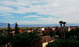
Kasba Tadla
Appearance
Kasbat Tadla
قصبة تادلة Qaşbat Tādlah | |
|---|---|
Town | |
Streetview | |
 | |
| Country | |
| Region | Béni Mellal-Khénifra |
| Province | Béni Mellal |
| Population (2004) | |
• Total | 40,898 |
| Time zone | UTC+1 (WET) |
| • Summer (DST) | UTC+2 (WEST) |
| Website | https://communekasbatadla.ma/ |
Kasba Tadla (Arabic: قصبة تادلة, romanized: Qaṣba Tadla) is a town in Béni-Mellal Province, Béni Mellal-Khénifra, Morocco. According to the 2004 census, it has a population of 40,898.[1] The highest temperature ever registered in Kasba Tadla was 47.0 °C (116.6 °F), on July 23, 2021.[2]
References
[edit]- ^ "World Gazetteer". Archived from the original on 2012-12-05.
- ^ "60190: Kasba-Tadla (Morocco)". ogimet.com. OGIMET. 23 July 2021. Retrieved 23 July 2021.
External links
[edit] Media related to Kasba Tadla at Wikimedia Commons
32°36′N 6°16′W / 32.600°N 6.267°W

