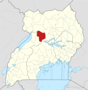
Karuma–Olwiyo–Pakwach–Nebbi–Arua Road
| Karuma–Olwiyo–Pakwach–Nebbi–Arua Road | |
|---|---|
| Route information | |
| Length | 133 mi (214 km) |
| History | Designated 2001 Expected completion in TBD |
| Major junctions | |
| Southeast end | Karuma |
| Olwiyo Pakwach Nebbi | |
| Northwest end | Arua |
| Location | |
| Country | Uganda |
| Highway system | |
The Karuma–Olwiyo–Pakwach–Nebbi–Arua Road is a road in the Northern Region of Uganda, connecting the towns of Karuma, Olwiyo, Pakwach, Nebbi and the city of Arua.[1]
Location
[edit]The road starts at Karuma, and proceeds in a northwesterly direction through Olwiyo, crossing the Albert Nile at Pakwach, going through Nebbi and ending at Arua, a distance of approximately 216 kilometres (134 mi), from end to end.[2] However, the roadworks as contracted, measured 237 kilometres (147 mi).[3]
Upgrading to bitumen
[edit]In 2001, the government of Uganda borrowed US$64.5 million (USh100 billion at that time), from the International Development Association, to upgrade this road to class II bitumen surface, with drainage channels, culverts and shoulders.[4] The work was completed in sections, starting with the Arua–Nebbi section, which was completed in December 2003.[5] The paved road continues to undergo periodic maintenance and rehabilitation.[6]
Points of interest
[edit]- The beginning of the road at Karuma, lies approximately 2 kilometres (1 mi), by road from the location of Karuma Hydroelectric Power Station, the largest hydroelectric power project in Uganda to date.[7]
- The section between Karuma and Olwiyo runs along the northern edge of Murchison Falls National Park.[3]
- At Olwiyo, this road makes a T-junction with the Acholibur–Gulu–Olwiyo Road.
- The Pakwach Bridge on this road, is the fourth permanent bridge across River Nile in Uganda, the others being (1) the Source of the Nile Bridge (2) the Isimba Bridge and (3) the Karuma Bridge.[8]
See also
[edit]References
[edit]- ^ Felix Warom Okello (6 December 2021). "Residents decry poor state of road". Daily Monitor. Kampala, Uganda. Retrieved 24 July 2022.
- ^ "Road Distance between Karuma, Uganda and Arua, Uganda" (Map). Google Maps. Retrieved 24 July 2022.
- ^ a b World Bank (8 June 2000). "Karuma–Pakwach–Arua Road: Final Feasibility Study Report, Volume 2: Environmental and Social Impact Assessment (ESIA)" (PDF). World Bank Group. Washington DC, United States. Retrieved 26 March 2016.
- ^ Hamis Kaheru and John Odyek (13 December 2001). "MPs approve Sh100 billion loan". New Vision. Kampala, Uganda. Retrieved 28 March 2016.
- ^ New Vision (26 September 2003). "West Nile youth to guard Karuma Road workers". New Vision. Kampala, Uganda. Retrieved 28 March 2016.
- ^ New Vision (18 December 2014). "Deteriorating state of Pakwach-Nebbi road". New Vision. Kampala, Uganda. Retrieved 28 March 2016.
- ^ "Road Distance Between Karuma, Uganda and Karuma Hydroelectric Power Station, Uganda" (Map). Google Maps. Retrieved 24 July 2022.
- ^ Solomon Oleny (12 February 2013). "The jinx and mysteries of Karuma Bridge". New Vision. Kampala, Uganda. Retrieved 4 October 2018.


