Karange Island
Appearance
| Karange Island | |
|---|---|
| Location | Tanga Region, Tanga District Tongoni |
| Nearest city | Tanga |
| Coordinates | 5°12′18″S 39°08′18″E / 5.20500°S 39.13833°E |
| Length | 11.0 km (6.8 mi) |
| Width | 2.4 km (1.5 mi) |
| Area | 16 km2 (6.2 sq mi) |
| Established | 2010 |
| Governing body | Marine Parks & Reserves Authority (Tanzania) |
| Website | Tanga Coelacanth Marine Park |
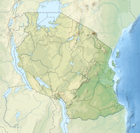
Karange Island ( Kisiwa cha Karange, in Swahili) is a small uninhabited and protected island in Mtangata Bay of Tongoni in Tanga District of Tanga Region, Tanzania. The island is located entirely with the Tanga Coelacanth Marine Park (TCMP). The island is administered by Tanzania Marine Parks and Reserves.[1][2][3]
References
[edit]- ^ "Marine Parks and Reserves Tanzania : Tanga Coelacanth Marine Park". Marineparks.go.tz. Retrieved 13 February 2022.
- ^ Horrill, J. C. "Collaborative fisheries management in the Tanga region." IUCN Tanga Coastal Management Project (1999).
- ^ Tarimo, Laura, and Norval Mare. "Rapid Socio-Economic Impact Assessment of Planned Marine Parks Legislation on Coastal Tourism: Focus on Tanga Region, Tanzania." (2012).

