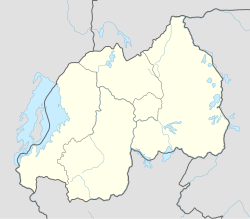
Karama, Rwanda
Appearance
Karama | |
|---|---|
Town and sector | |
| Coordinates: 1°23′44″S 30°09′14″E / 1.39549°S 30.15401°E | |
| Country | |
| Province | Eastern Province |
| District | Nyagatare District |
| Area | |
• Town and sector | 53.75 km2 (20.75 sq mi) |
| Population (2022 census)[1] | |
• Town and sector | 32,949 |
| • Density | 610/km2 (1,600/sq mi) |
| • Urban | 5,302 |
Karama is a small town and sector in Nyagatare District, Eastern Province in Rwanda with a population of 32,949 (2022 census) and an area of 53.75 square kilometers.
References
[edit]- ^ Citypopulation.de Population of Karama sector

