Kara-Üngkür
Appearance
| Kara-Üngkür | |
|---|---|
 | |
| Native name | |
| Location | |
| Country | Kyrgyzstan, Uzbekistan |
| Physical characteristics | |
| Mouth | |
• location | Kara Darya |
• coordinates | 40°52′35″N 72°19′39″E / 40.8764°N 72.3275°E |
| Length | 127 km (79 mi) |
| Basin size | 4,130 km2 (1,590 sq mi) |
| Basin features | |
| Progression | Kara Darya→ Syr Darya→ North Aral Sea |
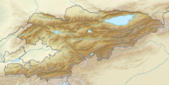
The Kara-Üngkür (Kyrgyz: Кара-Үңкүр), in its lower course Tentaksoy (Uzbek: Tentaksoy, Kyrgyz: Тентек-Сай) is a river in Kyrgyzstan and Uzbekistan. It is a large right tributary of the Kara Darya.[1] The river is formed at the confluence of the rivers Kyzyl-Üngkür and Arstanbap, which originate in the Fergana Range. The river's length is 127 km, and its basin size 4,130 km2.[2][3] It discharges into the Kara Darya near the town of Kuyganyor, north of Andijan. The Kara-Üngkür is used for irrigation. It flows along the villages Kyzyl-Üngkür, Oogon-Talaa, Charbak and Bazar-Korgon in Kyrgyzstan,[2] and Paxtaobod in Uzbekistan.
References
[edit]- ^ Караункюр in the Great Soviet Encyclopedia (in Russian) – via Great Scientific Library
- ^ a b "Караүңкүр" [Kara-Üngkür] (PDF). Кыргызстандын Географиясы [Geography of Kyrgyzstan] (in Kyrgyz). Bishkek. 2004. p. 194.
{{cite encyclopedia}}: CS1 maint: location missing publisher (link) - ^ "Basic hydrographic characteristics of rivers of Fergana valley". Retrieved 13 January 2022.

