Kangdong Airport
Appearance
Kangdong Airport | |||||||||||
|---|---|---|---|---|---|---|---|---|---|---|---|
| Summary | |||||||||||
| Airport type | Military | ||||||||||
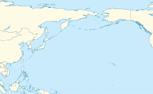
| Serves | Kangdong, North Korea | ||||||||||
| Elevation AMSL | 75 ft / 23 m | ||||||||||
| Coordinates | 39°09′29.60″N 126°02′25.40″E / 39.1582222°N 126.0403889°E | ||||||||||
| Map | |||||||||||
 | |||||||||||
| Runways | |||||||||||
| |||||||||||
Kangdong Airport (강동비행장) was an airport near Kangdong in Pyongyang, North Korea.
Facilities
[edit]The airfield has a single asphalt runway 03/21 measuring 3070 x 112 feet (936 x 34 m).[1] It is sited about 29 km east-northeast of Pyongyang.[2] It has a parallel taxiway for most of the length of the runway.
The airport was demolished in the period 2020-2024, with the airport now converted for agricultural use.
References
[edit]- ^ Landings database page Archived 2012-03-24 at the Wayback Machine "Landings.Com", accessed 12 Aug 2010,
- ^ GlobalSecurity.org "Air Bases - Kangdong", accessed 12 Aug 2010,


